

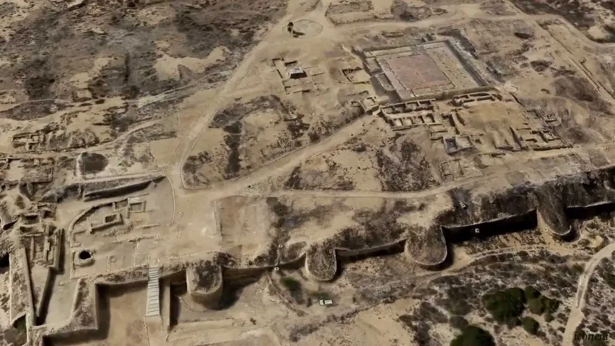
Banbhore is a ruined walled port on the northern bank of Gharo Creek in Thatta district, Sindh. The UNESCO tentative list entry places it 65 kilometres east of Karachi and dates its occupation from the first century BC to the thirteenth century AD. Many historians identify it with Debal (also written Daybul or Deybul), the harbour town that Arab forces took in 711 to 712.
In this article (29)
- Where Banbhore Lies on Gharo Creek in Thatta
- Banbhore Layout: Citadel, Suburbs and Industrial Quarter
- Streets, Houses and the Market Area
- The Defence Wall and Its Gateways
- The Grand Mosque of Banbhore and Its 727 Inscription
- Kufic Inscriptions Found in the Mosque Area
- The Debal Question: Is Banbhore the Port of 712?
- F. A. Khan’s Case for Debal at Banbhore
- Doubts Raised by Later Archaeologists
- Evidence Put Forward in Support Since 2012
- Four Periods of Settlement in the Banbhore Excavations
- The Shiva Temple in the Western Sector
- Four Building Phases of the Islamic Town
- Trade Goods, Coins and Crafts Found at Banbhore
- Ivory Workshops Found by the Italian Team
- The Excavation History of Banbhore from 1929 to Today
- Questions About the Partition Wall
- How the Port Declined and Was Abandoned
- Sassui, Punhun and the Banbhore of Sindhi Poetry
- Banbhore Museum and the Catapult Replica Outside
- World Heritage Status and the 2026 Nomination Push
- Visiting Banbhore: Timings, Tickets and Practical Tips
- Planning a Day Trip from Karachi
- Frequently Asked Questions About Banbhore
- Is Banbhore the Same Place as Debal?
- How Old Is the Mosque at Banbhore Today?
- Is Banbhore a UNESCO World Heritage Site?
- Why Was the Port at Banbhore Abandoned?
- Sources and Further Reading on Banbhore
The name is spelled in several ways. Newspapers and signboards use Banbhore, Bhambhore, Bhanbhore and Bambhore, and local people link the ruins with Sassui, the heroine of the Sindhi romance of Sassui and Punhun. This article uses “Banbhore” except when quoting a source.
What follows covers the site layout, the eighth century mosque, the long argument over whether Banbhore really is Debal, the excavations from 1958 to the present, and practical details for a visit. Where two sources give different figures, both are given with their source.
Where Banbhore Lies on Gharo Creek in Thatta
The ruins sit on the road between Karachi and Thatta, roughly halfway along it. Niccolò Manassero and Valeria Piacentini Fiorani, writing in The Silk Road journal in 2014, describe the site as rising “amidst swamps and mangroves” about 30 kilometres from the present shoreline. The Sindh antiquities department gives the distance from Karachi as 64 kilometres to the south east.
Gharo Creek was once a working channel of the Indus. In his paper on Debal and Mansura, the excavator F. A. Khan placed the ruins on the right bank of the creek, about twenty miles south west of Thatta. Today the creek is shallow and tidal, and the sea no longer reaches the old walls the way it did when ships tied up below the southern gate.
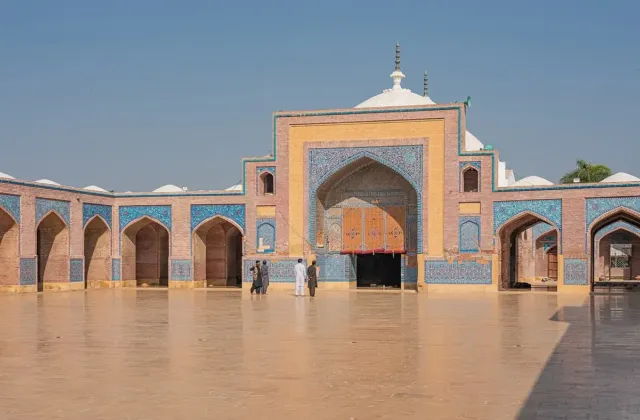
The same road carries visitors on to other heritage sites. The carved graves of the Chaukhandi Tombs lie closer to Karachi, while Keenjhar Lake, the Makli Necropolis and the Shah Jahan Mosque in Thatta lie further along towards the town of Thatta.
Banbhore Layout: Citadel, Suburbs and Industrial Quarter
The UNESCO entry divides the port into five main zones. The largest is a mound about 10 metres high standing right on the creek shore. It measures 610 by 305 metres and is enclosed by a limestone wall about 3 metres wide.
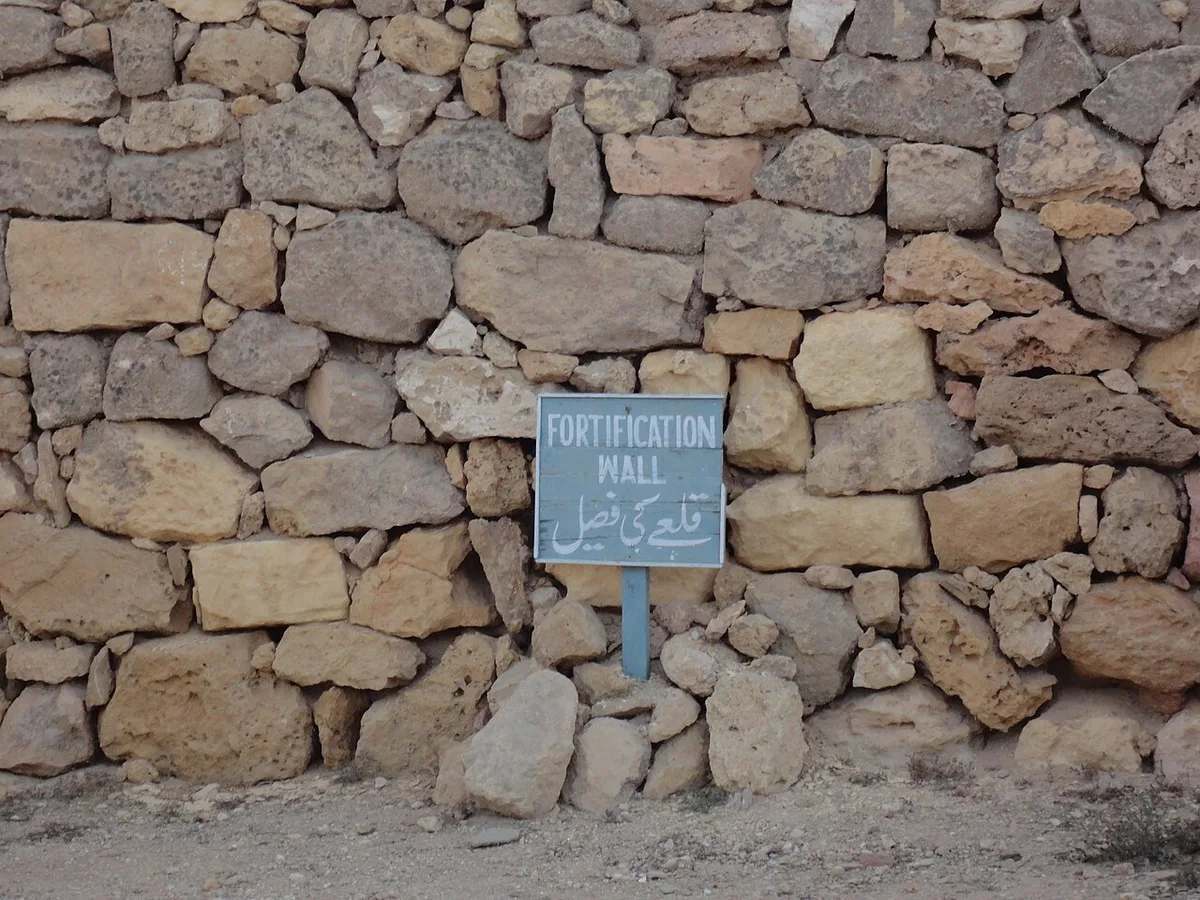
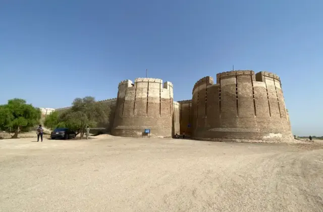
Counts of the towers differ. UNESCO gives 46 rounded bastions and three gates. The 2014 Silk Road paper, based on a fresh survey, counts 47 circular towers and 8 rectangular bastions. Both describe the same circuit; the newer map simply records more detail.
An inner wall splits the walled area into an eastern and a western half. On the eastern side, the floor plans of large buildings survive at ground level. UNESCO lists them as a mosque, an administrative quarter and a serai, or inn for travellers.
Outside the walls are two unfortified suburbs, one to the east and one to the north west, built mostly of mud brick. A large artificial tank sits at the north eastern corner of the mound. UNESCO describes it as the port’s supply of drinking water. Along the western edge of the tank runs an industrial area with evidence of textile work, glass making, glazing and metal working.
According to Manassero and Piacentini Fiorani, the citadel and the quarters around it cover about 65 hectares. They also note harbour structures beyond the walls that can still be seen at low tide.
Streets, Houses and the Market Area
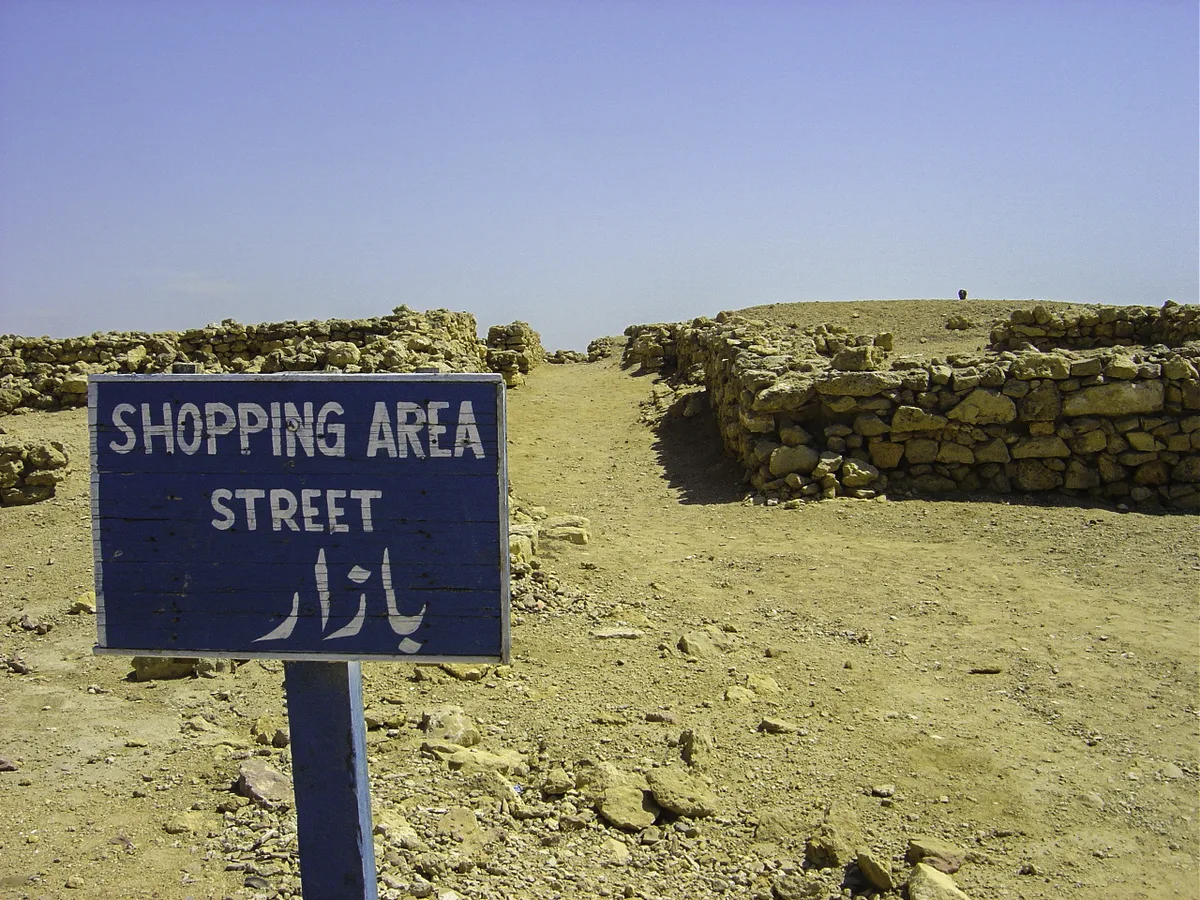
F. A. Khan found that the town was laid out with a network of streets and narrow lanes between blocks of houses. Most houses in the busiest period were of mud brick on stone foundations. Wealthier families used square burnt bricks and finished their floors and walls with lime plaster.
Khan also uncovered a palatial stone building with a semicircular shape. It had lime plastered floors, a stepped entrance and a large circular well lined with stone. The Herald report of 2016 notes that this building may have been the residence of a local ruler, though no inscription names its owner.
The Defence Wall and Its Gateways
Khan described the wall around the citadel as about 19 feet high, built of heavy semi dressed and undressed stones set in mud. Semicircular bastions stood at regular intervals, and a solid stone facing protected the base.
Three gateways were excavated. The southern one opens towards the creek and joins the main street of the town to the anchorage outside. Two large semicircular bastions guard it, and an entrance hall lies behind it.
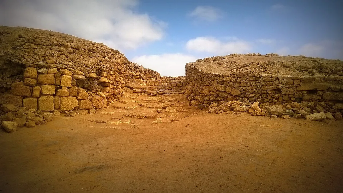
The anchorage in front of this gate is now half under water. Khan recorded a broad stone waterfront with long, heavy blocks that had grooved and rounded heads. He took them to be bollards for tying up cargo boats.
The Grand Mosque of Banbhore and Its 727 Inscription
The building that made Banbhore famous is its Grand Mosque, uncovered in the third season of excavation near the centre of the citadel. UNESCO calls it “the best preserved example of an early mosque in the region”, since other early mosques in South Asia were rebuilt over time.
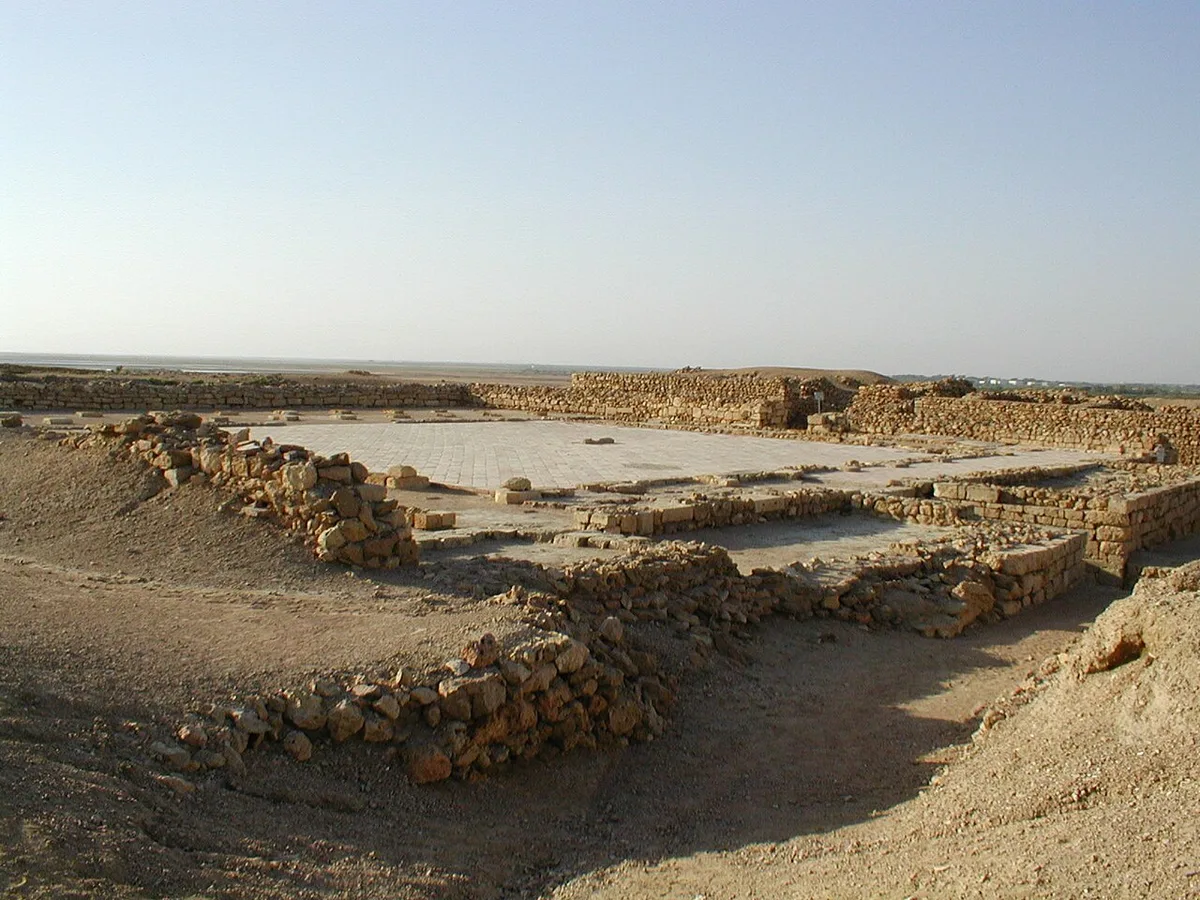
The plan is close to square. UNESCO gives the size as 34 by 35 metres. F. A. Khan, measuring in feet, gives 128 by 122 feet, with a paved courtyard of 75 by 58 feet in the middle. Covered cloisters ran around three sides of the courtyard.
The western side held the prayer hall. Its flat roof rested on 33 wooden pillars set in three rows on carved sandstone bases, and several of those bases were found in place. No mihrab was found in the western wall. Khan pointed out that the early mosques of Kufa and Wasit in Iraq also lacked one, since the mihrab was not yet treated as essential.
Kufic Inscriptions Found in the Mosque Area
Fourteen stone slabs carved with Kufic inscriptions came from the mosque area. Khan reported that two of them carry dates. The earlier is dated 109 AH, which is AD 727, and names the ruling amir of the time.
That date falls about sixteen years after the Arab conquest of Sindh, a gap UNESCO also notes. The entry adds that carved stones from earlier Hindu buildings were reused in the mosque, which points to a sharp change in the religious life of the town.
The Herald article of 2016 reports that one of the carved religious texts from the mosque is now displayed in the site museum.
The Debal Question: Is Banbhore the Port of 712?
The single most debated point about Banbhore is its old name. Arabic and Persian sources describe Debal as the main port at the mouth of the Indus. The Herald (Dawn) in 2016 explains that the name is often traced to the Sanskrit word devalaya, meaning “abode of God”, and that tenth century travellers wrote about its fishing boats and busy trade.
The capture of Debal opened the campaign of Muhammad bin Qasim and the Arab conquest of Sindh, which has its own article on this site. The question here is narrower: is the Debal of the chronicles the same place as the ruins on Gharo Creek?
F. A. Khan’s Case for Debal at Banbhore
F. A. Khan, who led the main digs from 1958, concluded that “Debal and Banbhore are one and the same”. His argument in the paper Debal and Mansura, the Historical Cities rests on three kinds of evidence.
- Distances. Al Masudi, writing in 915, placed Debal about two days’ journey from the mouth of the river. Khan read this as roughly forty miles by water. Banbhore lies about 80 miles from the site of Nirun near Hyderabad, which matches the four days the sources give between Nirun and Debal.
- Rival sites. He rejected Karachi as too far from Nirun, Lari Bandar as cut off among tidal channels, and Thatta as too far inland for sea going ships.
- Dated finds. The 727 inscription, coins of the Umayyad caliph Hisham, and a long Islamic sequence all fit a port that came under Arab rule early in the eighth century.
Khan suggested that the name Debal fell out of use after the town was abandoned in the thirteenth century, and that “Banbhore” was a later name.
Doubts Raised by Later Archaeologists
Not everyone accepted this. At the first International Conference on Bhambhore, held by the Sindh Culture Department in March 2012, archaeologist Kaleemullah Lashari questioned the identification. The Express Tribune reported his point that twelfth and thirteenth century Iranian mina and lustre wares, which should appear at a port active in that period, had not been found at the site.
The Herald article adds two more reasons for caution. In 2004, pottery from the site was found to have been dated wrongly, and only 17 pages of Khan’s field notes survive. Manassero and Piacentini Fiorani wrote in 2014 that the identification with Debal and with the Greek port of Barbarikon is “strongly debated and there is no general agreement among scholars”.
Evidence Put Forward in Support Since 2012
At the same 2012 conference, French archaeologist Monique Kervran argued the opposite case. She cited the geographer al Muqaddasi, who recorded an earthquake at Debal in the ninth century, and the thirteenth century writer Ibn al Mujawir, who reached the city by boat and mentioned seeing skeletons there. In her words, “the history of Bhambhore is the history of Deybal”.
Piacentini Fiorani took a firmer line after further work. Dawn reported in February 2019 that she said “There is no doubt it is Deybul”, while the director general of antiquities said a formal confirmation would be made later. Until such a statement is published, the identification is best described as widely held but not settled.
Four Periods of Settlement in the Banbhore Excavations
F. A. Khan’s deep trenches gave a section from the top of the mound to the lowest layer his team could reach. He recorded four main periods: Scytho Parthian, Sasanian, Hindu and Islamic, running from the second or first century BC to the thirteenth century AD.
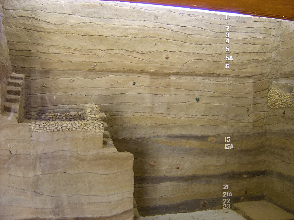
The lowest layers lie 25 to 30 feet below the surface and are waterlogged. From them came finely polished red pottery that Khan compared with second and first century BC wares found by John Marshall at Taxila. The Herald notes that the water table still stops archaeologists from reaching the natural soil beneath the town, so no one yet knows when the first settlers arrived.
The Shiva Temple in the Western Sector
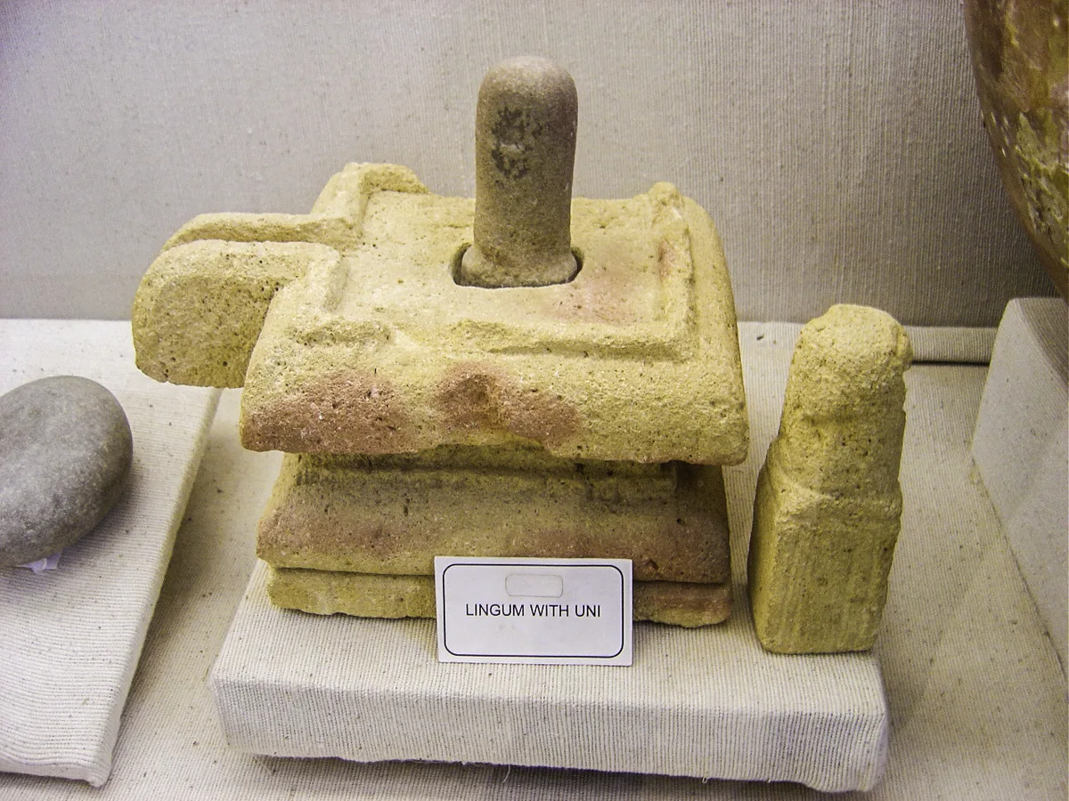
Below the Islamic levels in the western part of the site, Khan found a building with several coats of fine red paint over lime plaster. It had a plastered platform for a large image. Two lingams were recovered there, one complete with its yoni base, and Khan identified the building as a Shiva temple. It was the first Hindu building found in the pre Islamic levels.
Pre Islamic pots also carried short notes in an early Nagari script, written in black ink, that recorded weights. Terracotta heads, animal figurines and small grey stone statues came from the same levels.
Four Building Phases of the Islamic Town
Khan divided the Islamic town into four phases.
- Umayyad phase. The heavy stone defences of the citadel and solid stone buildings.
- Abbasid phase (eighth to ninth centuries). Mud brick houses on stone foundations, slip painted glazed wares and some imported Chinese celadon and porcelain.
- Third phase (to the early thirteenth century). Sgraffiato glazed pottery replaced most painted wares. Most of the excavated houses belong here.
- Last phase. A weak, poorly built wall around the eastern half of the citadel only, with the western half abandoned.
Trade Goods, Coins and Crafts Found at Banbhore
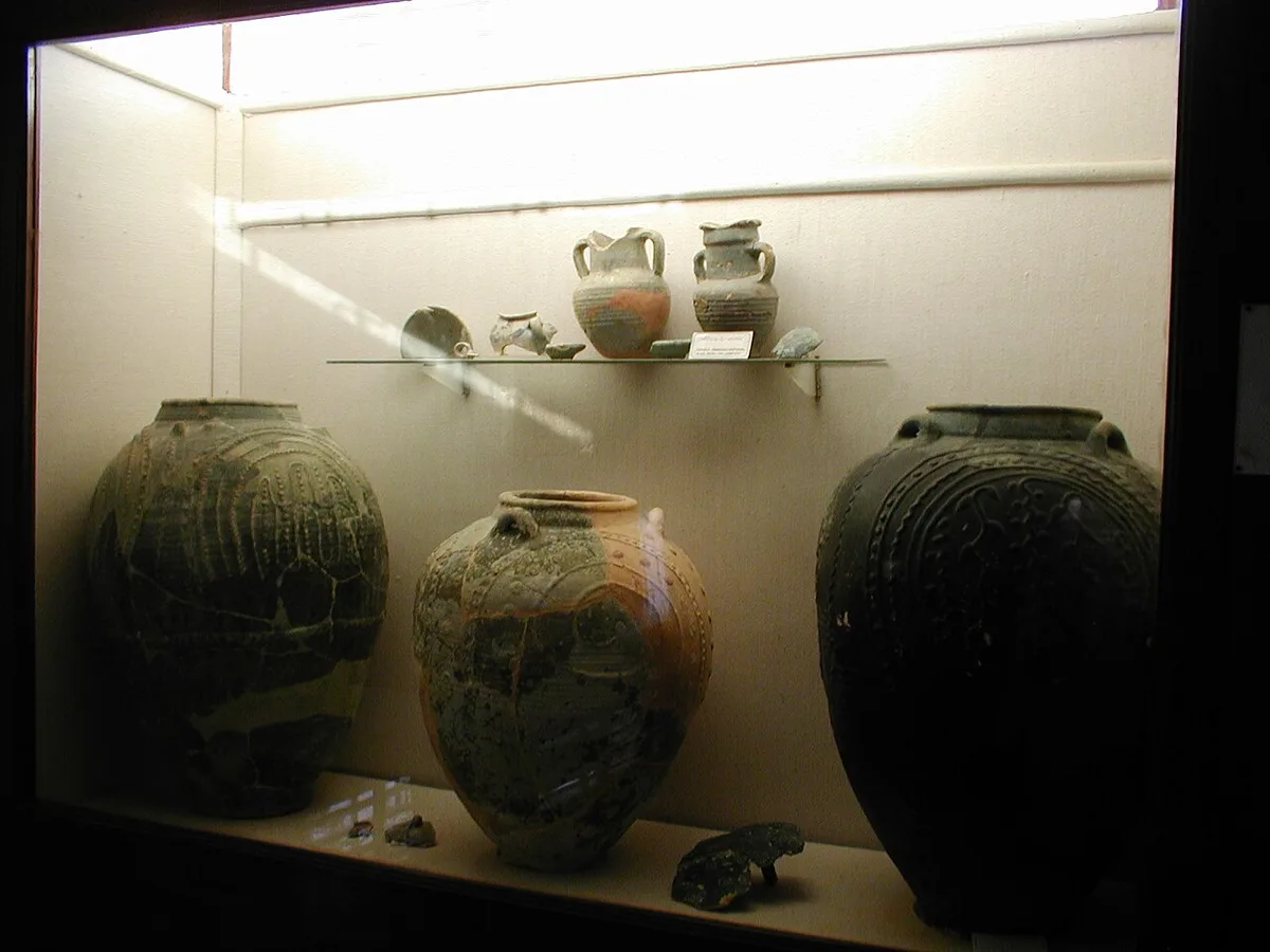
The finds show a port tied into long distance trade. Khan listed thin white Syrian style pottery, a small cup with a Kufic couplet like one from Susa in Iran, and large blue green glazed jars of Sasanian type. He also recorded painted pottery with ducks, fishes and peacocks that continued Sasanian designs.
Coins were found in large numbers. Khan reported a few thousand copper coins and about fifty silver ones, nearly all Islamic. Among them were silver coins of the caliphs Hisham and al Mamun, copper coins of a governor under the Abbasid caliph al Mansur, three Sasanian silver coins and one gold coin of the caliph al Wathiq.
Later analysis added detail. The 2014 Silk Road paper reports that small “copper” coins from the new trenches turned out to be an alloy of copper, lead and tin. It also notes that pre Islamic pottery once thought to be imported now appears, from laboratory tests, to be of local production.
Ivory Workshops Found by the Italian Team
One discovery stands out from the recent seasons. Piacentini Fiorani told Dawn in 2019 that the team had found ivory workshops of a kind not known from any other site. She described two grades of product, a cheaper one and an expensive one, and a chain in which each shop made one item and passed it on for the next stage of work.
The same report lists glass, part worked shells, worked bone, wood, iron and copper tools. Together they suggest a town where craft production and metal working went on alongside trade.
The Excavation History of Banbhore from 1929 to Today
Banbhore drew interest long before any large dig. According to Manassero and Piacentini Fiorani, Henry Cousens visited in 1929 and Nani Gopal Majumdar cut some trenches in 1930. The Herald adds that Cousens, then 75, found little on the surface at the place known as Sassi jo Takar, “Sassui’s hill”, and did not excavate.
Leslie Alcock, then with Pakistan’s Department of Archaeology, made trial excavations in 1951. The large programme under F. A. Khan began in March 1958. The Sindh antiquities department gives its end as 1965; the Herald gives 1966.
The site then lay largely untouched for decades. A French mission under Monique Kervran worked in the lower Indus delta between 1989 and 1995, at Ratto Kot, Lahori Bandar and Sehwan. In 2010 the Government of Sindh licensed a joint Pakistani, French and Italian project at Banbhore, with Lashari and Asma Ibrahim on the Pakistani side.
Dawn’s 2019 report explains what happened next. The licence expired in 2015. On 20 October 2017 the Sindh antiquities department signed a memorandum of understanding with the Catholic University of the Sacred Heart in Milan, and Italian and Pakistani teams have returned for further seasons since then.
Questions About the Partition Wall
A towered wall runs north to south across the citadel. Earlier writers called it the “Partition Wall” and thought it separated a Muslim quarter in the east from a Hindu quarter in the west. The Herald reported in 2016 that the joint team now dates it to the twelfth or early thirteenth century and believes it was built in haste as a last line of defence, not to divide religious communities.
How the Port Declined and Was Abandoned
Two causes appear in almost every account: a river that moved away and violence at the end. UNESCO states that the port’s role ended when the Indus shifted in the eleventh century and the creek silted up.
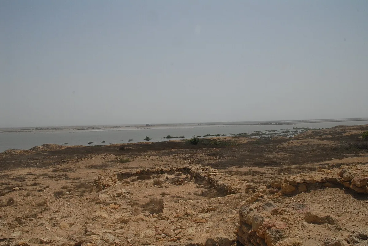
F. A. Khan placed the end a little later, around the middle of the thirteenth century. He pointed to damaged buildings, ash layers and human skeletons lying with arrowheads and sword blades. The last event he found in the written record was the invasion of Jalaluddin Khwarazm Shah in 1223. When Ibn Battuta passed through the delta in 1333 or 1334, he did not mention Debal at all.
The Silk Road paper also describes skeletons left unburied in houses and streets. Piacentini Fiorani, quoted in the Herald, put the town’s disappearance close to the end of the twelfth century and said it is hard to know whether war, natural disaster or both caused it.
Sassui, Punhun and the Banbhore of Sindhi Poetry
For many people in Sindh, Banbhore is first of all the town of Sassui. In the folk romance, Sassui wakes from sleep to find that her beloved Punhun is already gone, and the town ruled by her father fades from the story with him. The Herald notes that the story is about a thousand years old and was given lasting form by Shah Abdul Latif Bhittai in his Shah Jo Risalo.
At the 2012 conference, Karachi University’s Luqman Palari said that Bhittai mentions Bhambhore 67 times in his poetry, according to the Express Tribune. The poetic Banbhore and the excavated port may or may not be the same town; the sources reviewed here do not settle it, and archaeology has not tested the legend.
Banbhore Museum and the Catapult Replica Outside
A small site museum stands next to the ruins. The Herald says it was built in 1967 and lists storage jars, kitchen pots, copper and silver coins, metal objects, ivory, precious stones, jewellery and terracotta figures among its displays. It also holds a miniature scene of the battle between Muhammad bin Qasim and Raja Dahir.
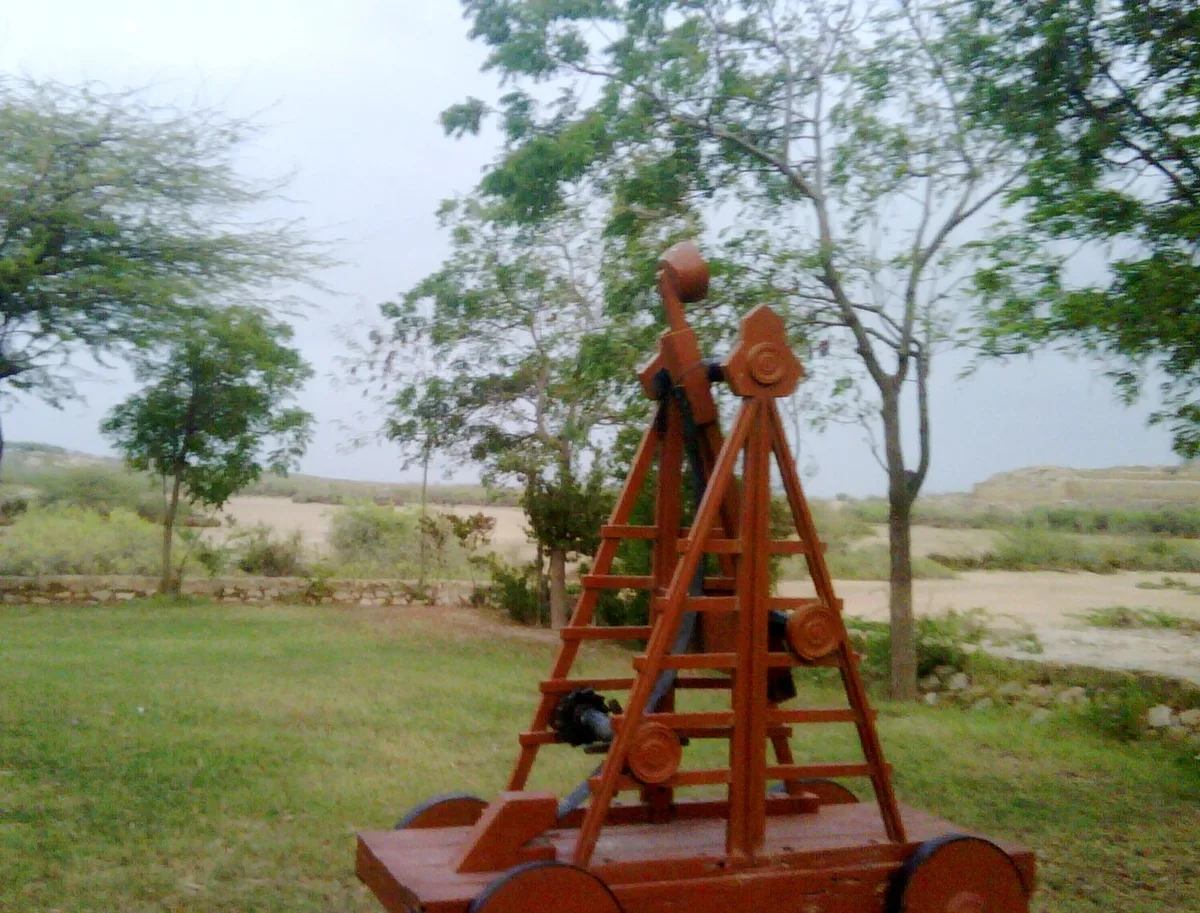
Outside the museum stands a full size replica of a catapult of the kind used in the siege. It is a modern reconstruction for display. Khan’s paper notes that heavy catapults were brought from Iraq for the attack on Debal.
World Heritage Status and the 2026 Nomination Push
Pakistan’s Department of Archaeology and Museums submitted the “Port of Banbhore” to UNESCO’s tentative list on 30 January 2004, under cultural criteria (iv), (v) and (vi). A tentative listing is only the first step; it does not make a site a World Heritage Site.
The case was raised again in 2026. Dawn reported on 3 September 2026 that the federal heritage minister had asked UNESCO’s representative in Pakistan to help add the Port of Banbhore and Rani Ghat to the World Heritage List. The same report said a World Heritage Committee visit to Banbhore was expected from 6 to 11 September. No outcome of that visit had been published at the time of writing.
Thatta district already has one inscribed site, the Makli Necropolis, so a successful nomination would give the district a second.
Visiting Banbhore: Timings, Tickets and Practical Tips
The Sindh antiquities department’s page for Banbhore lists the following details. Fees and hours can change, so it is worth checking with the department before travelling.
| Item | Details listed by the department |
|---|---|
| Site and museum hours | 9:00 am to 5:00 pm, open seven days a week |
| Ticket, Pakistani visitors | Rs 50 |
| Ticket, foreign visitors | Rs 1,500 (listed as USD 5) |
| Ticket, children | Rs 30 |
| Rest house | Single room Rs 2,500; double room Rs 5,000 |
Planning a Day Trip from Karachi
At about 64 kilometres from Karachi, Banbhore fits into a day trip from the city. The department’s page does not list any public transport to the site, so a private car or hired vehicle on the Karachi to Thatta road is the simplest way to reach it.
The ruins have little shade, and the surfaces are uneven stone and loose earth. The excavated walls are fragile, so it is best to stay on the marked paths and not climb on the bastions or the mosque bases. A visit can be combined with Makli and the Shah Jahan Mosque in Thatta on the same road.
Frequently Asked Questions About Banbhore
Is Banbhore the Same Place as Debal?
Many scholars think so, including F. A. Khan and Valeria Piacentini Fiorani. Others, such as Kaleemullah Lashari in 2012, have questioned it. The identification is widely held but has not been formally confirmed.
How Old Is the Mosque at Banbhore Today?
An inscription from the mosque area is dated 109 AH, or AD 727. That makes it one of the earliest dated mosques known in South Asia, and UNESCO calls it the best preserved early mosque in the region.
Is Banbhore a UNESCO World Heritage Site?
Not yet. It has been on Pakistan’s tentative list since January 2004, and in September 2026 the government asked UNESCO to help move it onto the main list.
Why Was the Port at Banbhore Abandoned?
The sources point to the silting of Gharo Creek after the Indus changed course, together with violent destruction. Excavators found skeletons with arrowheads in houses and streets of the last town.
Sources and Further Reading on Banbhore
- UNESCO World Heritage Centre, Port of Banbhore tentative list entry (2004)
- F. A. Khan, Debal and Mansura, the Historical Cities, Pakistan Journal of History and Culture (PDF)
- Niccolò Manassero and Valeria Piacentini Fiorani, The Site of Banbhore, The Silk Road 12 (2014) (PDF)
- Sama Faruqi, Resolving the mystery of an ancient site in Sindh, Herald (Dawn), 2016
- Dawn, Italian archaeologist says Bhambhore is no doubt Deybul, February 2019
- Express Tribune, Experts question if Bhambhore is the historical city of Debal, March 2012
- Dawn, Unesco asked to add Rani Ghat, Banbhore to heritage list, September 2026
- Directorate General of Antiquities, Government of Sindh, Banbhore Fort page

Leave a Comment