

Manchar Lake sits on the west side of the Indus in Jamshoro district, about 18 kilometres west of Sehwan. Sindh’s irrigation department and NASA’s Earth Observatory both call it Pakistan’s largest natural freshwater lake, while Britannica lists it only as one of the largest when it is full. A boat dwelling fishing people, the Mohana, have lived on it for generations.
In this article (38)
- Is Manchar Really the Largest Freshwater Lake in Pakistan?
- How the Lake Is Fed: Rivers, Canals, Torrents and Drains
- The Indus River and the Aral Wah Link
- The Danister Canal and Pumped River Water
- Hill Torrents from the Kirthar Range
- The Main Nara Valley Drain and Hamal Lake
- Ancient Settlements on the Shores of Manchar
- The Mohana People and Their Floating Homes
- Galiyo Houseboats and Hurro Fishing Boats
- How Many Mohana Still Live on the Water
- Why Families Moved to the Embankment
- A Project to Repair the Last Boat Village
- Fish and Birds: What the Records Actually Show
- The Fall in Fish Species and Catch
- Winter Birds Then and Now
- Salinity, Pollution and the Right Bank Outfall Drain
- What the Drainage Scheme Was Meant to Do
- Salt Readings in Recent Years
- Where the Government Projects Stand in 2026
- The 2010 Flood: A Twin River Ends in Manchar
- The 2022 Flood and the Deliberate Cuts in the Dyke
- Why Engineers Cut the Embankment
- Who Bore the Cost of the Relief Cuts
- Bubak, the Old Town on the Northeastern Shore
- Sehwan, the Shrine Town Next Door
- Planning a Visit to Manchar Lake Today
- Getting There from Hyderabad and Sehwan
- Choosing a Season with Care
- Health Points for Visitors
- Respecting Mohana Homes and Privacy
- Manchar Lake Timeline: Canals, Drains and Floods
- Common Questions Readers Ask About Manchar
- Can you drink or swim in Manchar Lake water?
- Why did officials cut the Manchar dyke in 2022?
- Do the Mohana people still live on houseboats?
- What is the RBOD and why does it matter here?
- How big is Manchar Lake in different seasons?
- Reference List for This Manchar Lake Guide
The story of Manchar Lake is also a story of engineering. Canals, regulators, a large drain and two deliberate cuts in its dyke have shaped it over the last hundred years. In 2026 the water is salty, the fish catch is small and only a few dozen houseboats are left.
This page covers where the water comes from, who lives on the lake, what happened in the floods of 2010 and 2022, where the clean up projects stand, and what a visitor should know. Where sources give different numbers, both numbers are shown with their source.
Is Manchar Really the Largest Freshwater Lake in Pakistan?
Yes, with one condition: it is the largest natural one, and only when it is full. The Sindh Irrigation Department calls it the largest natural freshwater lake in the country and one of the largest in South Asia. NASA’s Earth Observatory also calls it the country’s largest freshwater lake in its satellite notes from 2010 and 2022.
Britannica is more careful. It calls Manchar a marshy lake that covers about 36 square kilometres at low water and up to about 500 square kilometres when full. It says the lake ranks among the largest freshwater lakes only “on such occasions”.
Other figures fall between those two numbers. A 2015 report on Dialogue Earth (then The Third Pole) put it at about 200 square kilometres, growing to 500 in the monsoon. An AFP photo caption reused by Dawn in 2026 gives 223 square kilometres. So nobody can give one figure. Expect anything from about 36 to 500 square kilometres, depending on the month and on how wet the year was.
Some travel sites call Manchar the largest freshwater lake in Asia. None of the official or scholarly sources checked for this guide say that, so it is left out here.
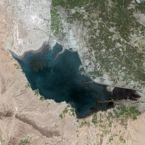
Manchar Lake seen by the SPOT satellite in 2003. Photo by CNES, Spot Image via Wikimedia Commons, licensed under CC BY SA 3.0.
How the Lake Is Fed: Rivers, Canals, Torrents and Drains
Manchar sits in a low basin between the Kirthar range to the west and the Indus to the east. Four sources feed it, and whichever one is strongest in a given year decides if the water tastes fresh or salty.
The Indus River and the Aral Wah Link
The main link with the river is the Aral Wah, a channel that runs between the lake and the Indus near Sehwan. In 2010 Dawn described its head and tail regulators as “double action” works, used both to fill the lake from the river and to empty it into the river.
In good flood years the Indus used to top up Manchar through the Aral Wah. A Dawn report from July 2026 says this rarely happens now; the last time the river fed the lake well was in 2024. In August 2026 river water came in again through the Aral head and tail channels and raised the level by about four feet.
The Danister Canal and Pumped River Water
A second freshwater route is the Danister canal. In June 2006 the Sindh government began a scheme to pump 200 cusecs of Indus water into the lake through this canal using 12 pumps. Dawn reported the cost as Rs50 million. Officials said up to 500 cusecs could be sent when the river was high, and that about 30 small branches of the canal would also water farmland.
I could not find any later report on how long those pumps ran, so I am not saying they still work.
Hill Torrents from the Kirthar Range
West of the lake, seasonal streams come down from the Kirthar Mountains. According to the irrigation department, a number of small hill streams empty into Manchar. One of them is the Gaj, often called the Nai Gaj.
A dam on the Gaj has been under construction since 2012. Dawn reported in July 2026 that its design includes a 52 kilometre pipeline to send 50 cusecs of fresh water to Manchar. Court cases have slowed the work, and in July 2026 the Federal Constitutional Court told the contractor to finish the dam under the original contract.
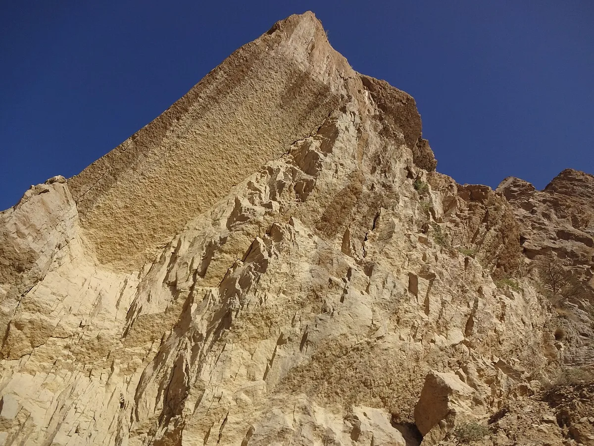
Rock face of the Kirthar range near Gorakh Hill, photographed in May 2015. This is not Manchar itself; it shows the hill country whose seasonal torrents drain towards the lake. Photo by Allah Dad Rind via Wikimedia Commons, licensed under CC BY SA 4.0.
The Main Nara Valley Drain and Hamal Lake
The fourth source is the one that changed the lake most. The Main Nara Valley Drain (MNVD) runs south from Hamal Lake, about 160 kilometres north according to NASA, and ends in Manchar.
Its start date differs by source. The irrigation department’s date is 1921. Dialogue Earth’s 2015 timeline puts construction in 1932 and gives the channel’s length as roughly 111 kilometres. This guide gives both years.
The channel was first meant to carry flood water and farm drainage. Later it became part of a larger drainage scheme, and today the MNVD is also called RBOD I. That change is the root of the salinity problem described further down.
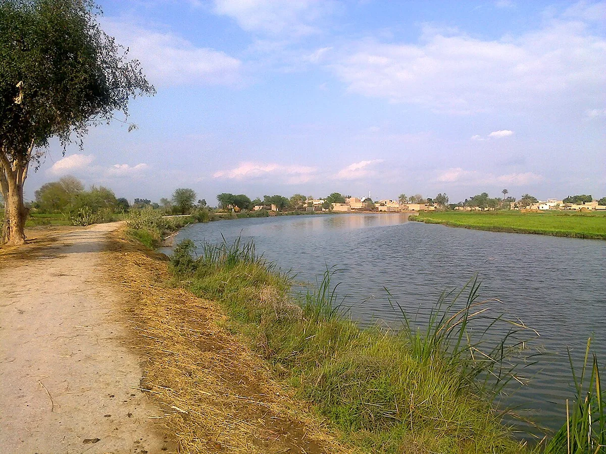
A channel the photographer calls the Naro, described on Commons as an old freshwater channel from Shikarpur to Dadu that ends in Manchar Lake. Photographed in March 2015. Photo by Naveed Solangi via Wikimedia Commons, licensed under CC BY SA 4.0.
Ancient Settlements on the Shores of Manchar
People lived around Manchar Lake long before the canals. The irrigation department lists three sites on its edge, Lal Chatto, Mashak Lohri and Lakhiyo, as the oldest and links them to the Harappan culture. It also names nearby mounds at Ghazi Shah, Wahi Pandhi and Ali Murad.
These places belong to the same world as the cities described in our guide to the Indus Valley Civilisation. Most of them have not been dug in recent decades. They are not set up for visitors.
The Mohana People and Their Floating Homes
The Mohana (also written Mohanna) are the fishing community best known for living on the lake itself. A long feature in Dawn’s EOS magazine in February 2026, “The Last of the Mohannas“, is the most detailed recent account and is the main source for this section.
Galiyo Houseboats and Hurro Fishing Boats
A family home on the water is called a galiyo. Dawn gives its size as about 38 feet long and 10 feet wide. The boats are built from local wood and reeds and have a low freeboard so they ride the changing water.
Galiyos cluster into floating villages and move apart again with the water level, the fish and the wind. Smaller boats called hurro are used for fishing. Dialogue Earth also describes a narrow boat, the batelo, which is pushed along with a pole against the lake bed.
Dawn splits the Mohana calendar into three parts: sawan, the monsoon from July to September; machhi maran, the fishing season from October to March; and sukkal, the dry months from April to June.
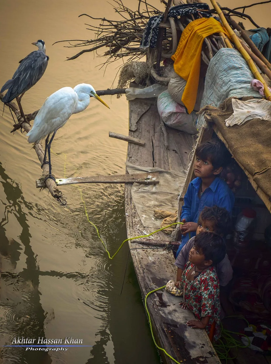
Mohana children on a houseboat in Sindh, photographed in December 2018. Where exactly it was taken is not recorded on Commons. Photo by Akhtar Hassan via Wikimedia Commons, licensed under CC BY SA 4.0.
How Many Mohana Still Live on the Water
Nobody has run a proper census on the water. The numbers below come from activists and journalists, so treat them as rough. Read them as a rough trend:
- 1980s: about 20,000 people on the lake, according to the Pakistan Fisherfolk Forum, quoted by Dialogue Earth in 2015.
- Around 2004: nearly 2,000 houseboats, as one fisherman recalled to Dawn’s Herald magazine in 2018.
- 2015: roughly 4,000 to 5,000 people still living on the water (same Fisherfolk Forum estimate).
- 2026: about 375 people in some 65 families, living on 44 galiyos (Dawn, February 2026).
One trend is clear from every source. The floating village has shrunk from thousands of people to a few hundred within about 40 years.
Why Families Moved to the Embankment
Most families did not leave by choice. As the catch fell, they moved onto the lake’s embankment, known locally as Bund Manchar, or migrated. Dialogue Earth reported that some men went to fish in the sea off Gwadar and Pasni in Balochistan.
Drinking water is a daily problem. In October 2026 a woman living on Bund Manchar near Bubak told Dawn that 12 reverse osmosis plants on the bund and 38 more in nearby villages were not working. Families were paying about Rs30 for each jerrycan from private tankers. Earlier reporting links the bad water to skin, eye and stomach illness.
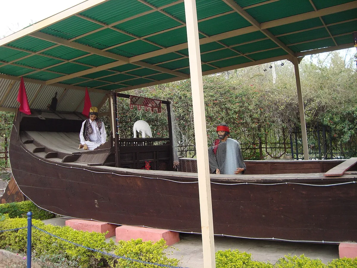
A full size replica of a traditional houseboat on display. The Commons coordinates place it in Islamabad, not at the lake, so it shows the design rather than a working boat. Photo by Laila Khaan via Wikimedia Commons, licensed under CC BY SA 3.0.
A Project to Repair the Last Boat Village
In 2024 the Heritage Cell of the Department of Architecture and Planning at NED University in Karachi began a project funded by the UK government’s Cultural Protection Fund. It was led by Professor Anila Naeem and Farida Abdul Ghaffar.
Dawn reports that the team repaired 44 badly damaged houseboats and built new hurro fishing boats. It also brought a mobile water filter, eco toilets, solar power and a small learning centre that now sits on a floating bamboo platform.
The same report is frank about the limits. New planks will not make the water clean. Those running the work told Dawn the repairs only buy a few years; the lake still needs fresh river water and an end to the drain.
Fish and Birds: What the Records Actually Show
Many websites list dozens of bird and fish species for Manchar. Few of those lists name a survey. The figures below are the ones that can be traced to a named source.
The Fall in Fish Species and Catch
Dialogue Earth cites a 1999 survey by the Sindh Education Foundation that found about 200 fish species in Manchar Lake around 1930, of which 14 had since died out. Dawn’s 2026 feature also gives “over 200” species for the middle of the twentieth century.
The catch tells the same story. Mustafa Mirani of the Pakistan Fisherfolk Forum told Dialogue Earth the yearly catch fell from about 2,300 tonnes in 1944 to about 700 tonnes in the 1980s. He estimated it at no more than 75 tonnes in 2015. That 2015 number is his guess, not a government statistic.
Much of what is caught now is small fish. Both Dialogue Earth and Dawn report that a large share is dried and ground into poultry feed rather than eaten.
Winter Birds Then and Now
Dawn’s 2026 feature says tens of thousands of migratory birds once spent the winter at Manchar, including pelicans, ducks, cormorants and egrets. Another Dawn piece, from July 2026, says Manchar “once received large flocks” each winter, and that far fewer come these days.
No recent, published bird count for Manchar Lake was found for this guide. A figure that circulates online (25,000 birds in 1988 falling to 2,800 in 2002) could not be traced to an original survey, so it is not used here.
Scientists have even named a creature after the place. A parasite of the common coot, Paramonostomum bubaki, was described from birds of Manchar and named after the nearby town of Bubak in a 2013 paper.
Salinity, Pollution and the Right Bank Outfall Drain
The single biggest change to Manchar came from drainage. The Right Bank Outfall Drain (RBOD) is a network of drains serving the right bank districts of the Indus. It was meant to take salty water away from farmland in upper Sindh and Balochistan. In practice, much of that water has ended up in the lake.
What the Drainage Scheme Was Meant to Do
According to the 2015 Dialogue Earth timeline, WAPDA built the North Dadu surface drain in 1976 to send drainage into Manchar through the MNVD. A Right Bank Master Plan followed in 1992. Then came an idea to push the lake’s dirty water into the Indus by way of the Indus Link canal, and objections stopped it.
Work on RBOD II began in 2001. Its job is to carry drainage from near Sehwan past the lake to the sea. Dawn describes a design flow of 3,525 cusecs to a creek in Thatta district. A further drain, RBOD III, was built to carry effluent from Balochistan into the system.
The idea was that RBOD II would take the dirty water away before it reached Manchar. Because RBOD II was never finished, the drains upstream kept emptying into Manchar Lake.
Salt Readings in Recent Years
An official of the Sehwan irrigation office told Dawn in October 2026 that the lake was holding about 4,000 TDS (total dissolved solids, a measure of salt). It had been around 6,000 before fresh river water arrived in August. He said the MNVD was still sending about 2,000 cusecs a day into the lake.
Look at 2026 to see how fast the level moves. It stood at 108.4 feet on the irrigation gauge on 29 July 2026 and about 112 feet by 1 September. Earlier in the summer, Dawn reported long stretches of dry lake bed seen from the embankment.
Water quality studies have tracked the problem for years. A 2008 paper by Mastoi and colleagues in Environmental Monitoring and Assessment looked at water quality in Manchar Lake. Later papers by Jahangir, Khuhawar and coauthors (2015 and 2023) compared the water before and after the 2010 flood and traced what the drains bring in.
Dawn’s 2026 feature also warns that the same early signs, falling inflows and rising waste, are showing at other Sindh lakes such as Haleji and Keenjhar Lake.
Where the Government Projects Stand in 2026
The status of RBOD II is the key question. In July 2026 the Sindh irrigation secretary told the provincial assembly’s Public Accounts Committee that the department had decided to halt the project. The Express Tribune and Dawn both reported the meeting.
The facts given at that meeting were these. RBOD II is 273 kilometres long. It was approved in 2001 at Rs14 billion and later revised to about Rs62 billion. Around Rs40 billion has been spent, and work has been stopped since 2015. Officials said finishing it would now need about Rs300 billion more. The committee asked for a desalination and recycling plant near the lake and for a consultant to be hired.
A second effort is Recharge Pakistan, a WWF Pakistan programme. In July 2025 Dawn reported that it would spend about $8 million at Manchar by 2031, including digging out and restoring about 30 kilometres of old waterways. No results have been released so far.
Courts have tried before. Back in 2017 the Supreme Court told the authorities to monitor Manchar and control pollution, yet Dawn says that order was never followed through.
The 2010 Flood: A Twin River Ends in Manchar
In August 2010 the Indus broke its banks upstream. NASA’s Earth Observatory wrote that by early September the water west of the river had formed a “twin river” that ended in Manchar Lake.
Dawn’s reporter at Bubak in mid September described the scene. Irrigation staff had made a breach between RD 11 and RD 12 of the lake’s containing embankment. The aim was to send water back to the Indus through the Aral head regulator and protect Bhan Saeedabad and Sehwan.
By mid September the numbers were frightening. Manchar normally tops out at 117 feet on the gauge, and the dyke had been raised so it could hold 123. On 15 September the level was touching 122 feet. Almost everyone in Bubak town had left.
Some fishermen hoped for one benefit. Fresh Indus water brings fingerlings with it, so Fisherfolk Forum leaders were counting on bigger catches after the flood went down.
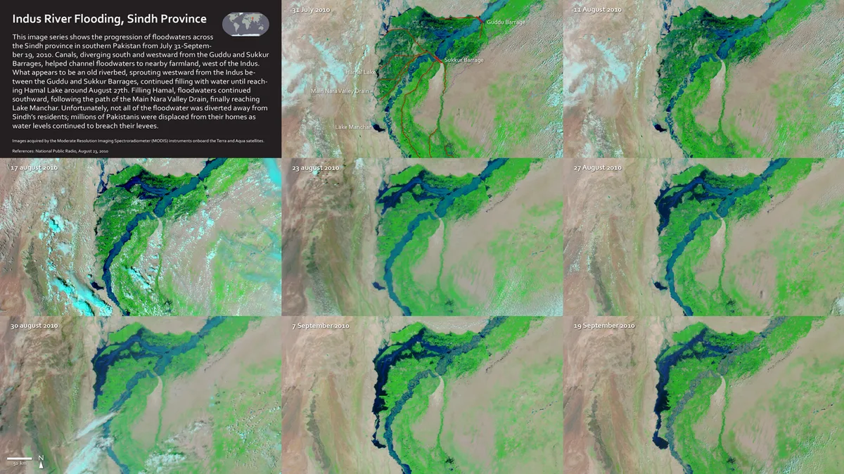
NASA satellite images tracking how the 2010 floodwater spread west of the Indus and into Manchar Lake. Photo by NASA Scientific Visualization Studio via Wikimedia Commons, licensed under Public domain.
The 2022 Flood and the Deliberate Cuts in the Dyke
In 2022 record monsoon rain filled Manchar Lake from all sides at once. The MNVD was pouring water in, the Kirthar streams were in spate, and the Indus was too high to take any water back.
Why Engineers Cut the Embankment
Dawn reported that the lake reached 124.3 feet against a danger mark of 122 feet. On Sunday 4 September the irrigation department made a “relief cut” between RD 14 and RD 15, at a place called Yusuf Bagh or Bagh i Yousuf. Officials said the purpose was to save the larger towns of Sehwan and Bhan Saeedabad.
On the night of 5 September a second cut was made at RD 52. By then water had reached Sehwan’s airport and a nearby oil facility. Speaking to Dawn, the deputy commissioner said the aim was to save Dadu and Jamshoro.
Sindh’s chief minister said the decision was “unwanted” but had to be taken. His own home town, Wahur, went under after the first cut, Dawn pointed out.
Who Bore the Cost of the Relief Cuts
The cuts moved the flood from towns onto villages. Figures differ by source and by date:
- Dawn: about 100 villages in five union councils (Jaffarabad, Bubak, Wahur, Channa and Arazi) flooded after the first cut.
- BBC: an estimated 400 villages and 135,000 people affected by the planned breaches.
- NASA Earth Observatory: several hundred villages and more than 100,000 residents in the path of the water.
- Dawn, later in September: ten union councils of Sehwan taluka under water.
Even so, the water kept climbing. On 9 September water reached the outskirts of Bhan Saeedabad after a seasonal channel, the Dal branch, gave way, and residents built a ring embankment around the town (Dawn). Engineers then made four more cuts in the Larkana Sehwan dyke along the river. On 20 September they cut through the Indus Highway near Sehwan toll plaza to let water drain faster. By then the lake level was already falling.
Whether the cuts were the right call is still debated in Sindh. What the record shows is that the decision was made under pressure, that warnings were given, and that people in the villages east of the lake carried most of the damage.
Bubak, the Old Town on the Northeastern Shore
Bubak stands on the northeastern edge of the lake. An 1874 gazetteer, summarised on Wikipedia, places it about 9 miles west of Sehwan, with roads to Bhan and Talti.
Its population depends on who is counting. The 2017 census gave the town 5,563 people and the wider union council 28,776. Dawn, writing in 2022, put Bubak at “around 25,000” people; that number is close to the union council total, so the paper was likely counting the wider area.
Bubak has a long past. Wikipedia, citing a 2020 paper, says peasants from Bubak built a large dam south of the lake under Darya Khan, a commander of the Samma ruler Jam Nizamuddin. It became a municipality in July 1854. By 1874 it had a moat around it to keep the lake out, and it was known for carpets.
The town has lived with the lake’s moods in every recent flood. It was emptied in 2010 and flooded after the first relief cut in 2022. Naseer Memon, quoted by Dialogue Earth, recalled a busy Bubak railway station in the 1990s where fish were loaded for cities as far as Lahore. Fifteen years later, by his account, trains had stopped calling at Bubak altogether.
Sehwan, the Shrine Town Next Door
Most visitors reach Manchar through Sehwan, the town of the shrine of Lal Shahbaz Qalandar. Its history, the shrine and the urs are covered in our separate guide to Sehwan Sharif, so they are not repeated here. Many people combine the two in one trip.
Planning a Visit to Manchar Lake Today
Manchar is not a resort lake. Families fish here for a living, drink tanker water and sit out summers above 40°C on the bank, so plan a visit around their routine rather than your own.
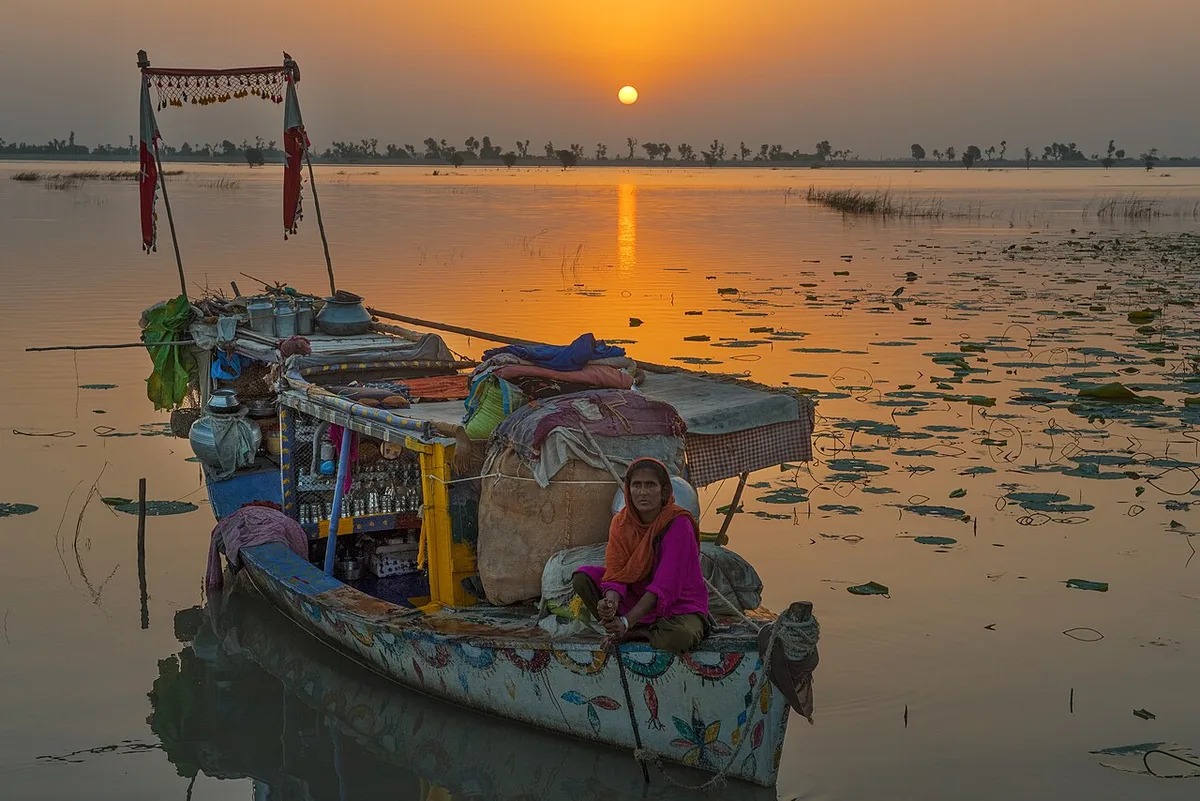
A Mohana houseboat at sunset, photographed in September 2015. This photo was taken on the Indus near Attock in Punjab, not at Manchar; it is used to show the boat dwelling way of life. Photo by Tariq Hameed Sulemani via Wikimedia Commons, licensed under CC BY SA 4.0.
Getting There from Hyderabad and Sehwan
From Hyderabad, the drive north to Sehwan along the right side of the river covers roughly 130 kilometres. From Sehwan, the irrigation department puts Manchar Lake about 18 kilometres to the west.
The lake’s embankment is known locally as Bund Manchar, and fishing families live along parts of it, including near Bubak on the northeastern shore (Dawn, 2026). Floods washed out these roads in 2010 and again in 2022; after heavy rain, look at Sindhi or Urdu local news before you set off.
Choosing a Season with Care
No official tourism body publishes a best time to visit Manchar, so this guide does not name one. The sourced facts below can help you decide:
- The Mohana fishing season, machhi maran, runs from October to March (Dawn).
- Migratory birds come in winter, though in smaller numbers than before (Dawn, 2026).
- Summer heat goes beyond 40°C, and Dawn describes workers repairing boats in that heat in 2024.
- The monsoon, July to September, is when the lake can rise fast, as in 2010 and 2022.
- In dry years parts of the bed can be exposed for months, as Dawn saw in summer 2026.
Health Points for Visitors
Avoid drinking from or bathing in Manchar Lake. Salt readings in 2026 were high, and residents themselves buy drinking water from tankers. Carry your own water and food.
Small boats on the lake belong to local fishermen. If you go out, go with someone who knows the lake, and keep away from the embankment when the water is high. In 2022, officials said the rising lake had left its dykes vulnerable to breaches (Dawn).
Respecting Mohana Homes and Privacy
People sleep, cook and raise children on the galiyos. Ask before you step on a boat or take a photo, especially of women and children. A Mohana fisherman told Dawn in 2026 that officials “take photos and write reports, but the water stays the same”. Keep his words in mind before raising your phone.
Hiring a boat or buying a fish? Hand the money to the boatman or fisher himself, not to a middleman on the bank. And carry your plastic bottles and wrappers back to Sehwan, because the MNVD already brings plenty of rubbish into the lake.
Manchar Lake Timeline: Canals, Drains and Floods
| Year | Event | Source |
|---|---|---|
| About 1930 | Around 200 fish species recorded in the lake | Sindh Education Foundation survey, via Dialogue Earth |
| 1921 or 1932 | Main Nara Valley Drain links Hamal Lake to Manchar (sources differ) | Sindh Irrigation; Dialogue Earth |
| 1944 | Yearly fish catch about 2,300 tonnes | Pakistan Fisherfolk Forum, via Dialogue Earth |
| 1976 | North Dadu surface drain sends drainage into the lake via the MNVD | Dialogue Earth |
| 2001 | Work starts on RBOD II to carry drainage to the sea | Dawn; Express Tribune |
| 2006 | Pumping scheme sends Indus water through the Danister canal | Dawn |
| 2010 | Flood forms a “twin river” ending in Manchar; breach at RD 11 to RD 12 | NASA; Dawn |
| 2015 | Work on RBOD II stops | Express Tribune |
| 2022 | Relief cuts at RD 14 and RD 52 on 4 and 5 September | Dawn; BBC |
| 2024 to 2025 | NED University repairs 44 houseboats | Dawn |
| 2025 | WWF Pakistan’s Recharge Pakistan plans work at Manchar until 2031 | Dawn |
| 2026 | Irrigation department halts RBOD II; lake salinity about 4,000 TDS | Express Tribune; Dawn |
Common Questions Readers Ask About Manchar
Can you drink or swim in Manchar Lake water?
No. In October 2026 the lake recorded about 4,000 TDS of salt, and drainage from the MNVD still flows in. Local families buy drinking water from tankers. Carry bottled water from Sehwan and do not swim.
Why did officials cut the Manchar dyke in 2022?
The lake rose above its danger mark while the Indus was too high to take water back. Officials made cuts at RD 14 and RD 52 on 4 and 5 September to protect Sehwan, Bhan Saeedabad, Dadu and Jamshoro. The water then flooded villages east of the lake instead.
Do the Mohana people still live on houseboats?
A small number do. Dawn reported about 375 people in 65 families living on 44 galiyos in 2026. That is down from thousands in the 1980s, by most estimates. Many others now live on the embankment or have moved away to find work.
What is the RBOD and why does it matter here?
The Right Bank Outfall Drain is a set of drains that carry salty farm water from districts on the right bank of the river. Without its unfinished RBOD II section, much of that water ends up in Manchar. This is the main reason Manchar Lake has turned salty.
How big is Manchar Lake in different seasons?
Britannica gives about 36 square kilometres at low water and about 500 when full. For an ordinary year, other sources give 200 to 260 square kilometres. The size depends on rain, river flows and drainage in that particular year.
Reference List for This Manchar Lake Guide
- Sindh Irrigation Department, Manchar Lake page
- Encyclopaedia Britannica, Manchhar Lake
- NASA Earth Observatory, Indus River and Manchhar Lake, September 2010
- NASA Earth Observatory, Lake Manchar is Overflowing, September 2022
- Dialogue Earth (The Third Pole), Photo story: The destruction of Pakistan’s Manchar lake, by Zofeen Ebrahim, September 2015
- Dawn EOS, The Last of the Mohannas, by Rumana Husain, February 2026
- Dawn, Effluents turn once pristine Manchar Lake toxic, October 2026
- Dawn, The drying of Manchhar Lake, July 2026
- Express Tribune, RBOD II declared unviable as government halts project, July 2026
- Dawn, Plan to revive Manchar Lake, July 2025
- Dawn, Manchhar lake to get water from Indus, June 2006
- Dawn, Manchhar fishermen ready boats in hope of abundant catch, September 2010
- Dawn, Relief cut on Manchhar dyke aggravates flooding in five Sindh UCs, September 2022
- Dawn, Another cut in Manchhar as water threatens airport, September 2022
- Dawn, Indus highway cut to accelerate outflows from Manchhar, September 2022
- BBC News, Officials struggle to stop biggest lake overflowing, September 2022
- Wikipedia, Bubak, Sindh (citing the 1874 Gazetteer of Sindh and the 2017 census)
- Mastoi, Shah and Khuhawar, Assessment of water quality of Manchar Lake in Sindh, Environmental Monitoring and Assessment, 2008

Leave a Comment