

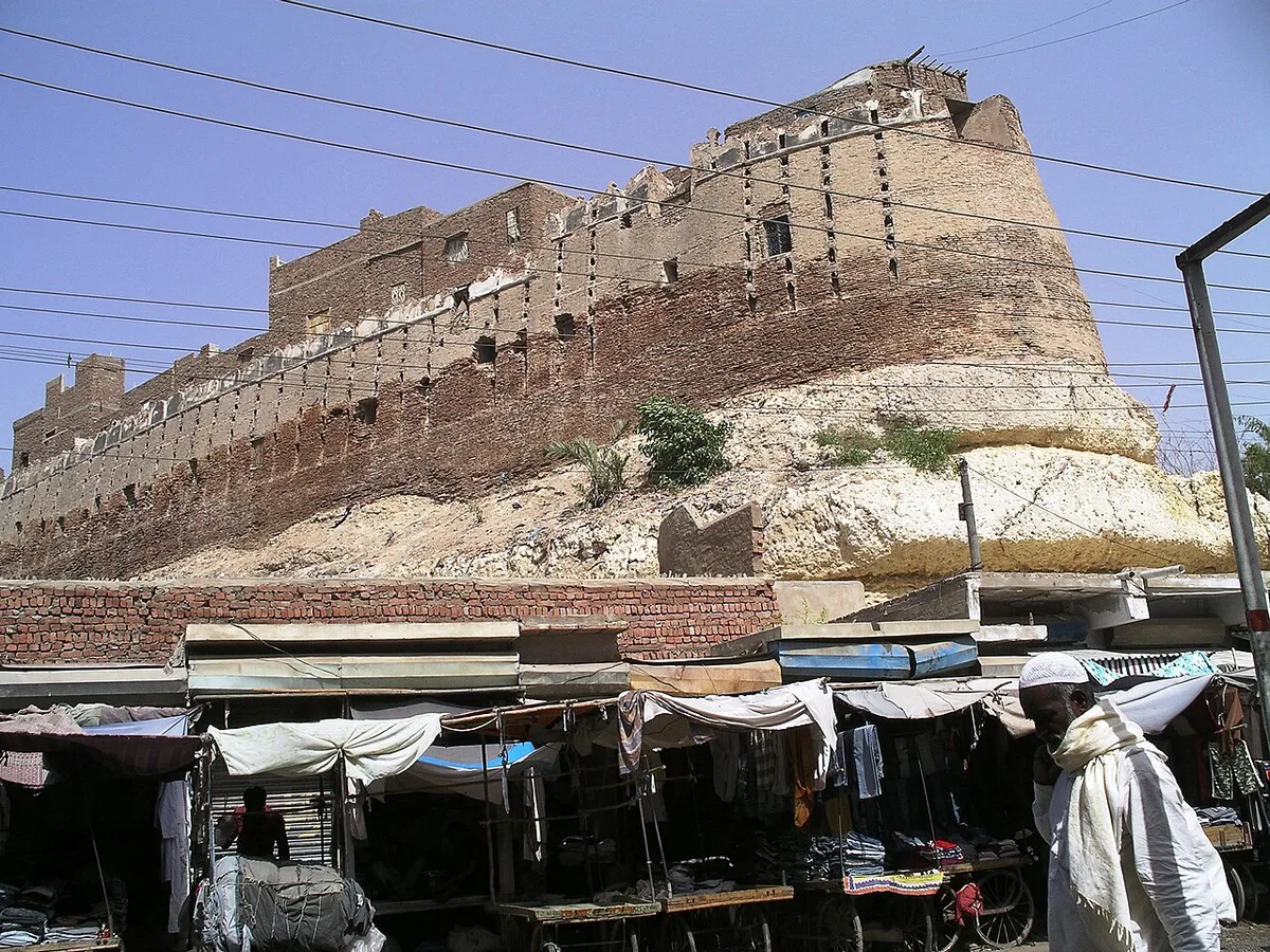
Pakka Qila is the old brick fort at the centre of Hyderabad, Sindh. It is also written Pacca Qila or Pucca Qila, and in Sindhi it is Pakko Qilo. The Sindh Antiquities Department records that Mian Ghulam Shah Kalhoro founded the town and the fort in AH 1182, which is AD 1768, and made the place his capital.
In this article (24)
- What the Name Pakka Qila Means and Where It Stands
- Mian Ghulam Shah Kalhoro and the Founding of the Fort
- Why the Capital Moved from Khudabad
- The Hill of Ganjo Takkar and Old Nerun Kot
- Who Built the Fort and in Which Year
- The Fort Under the Talpur Mirs of Sindh
- Mir Fateh Ali Khan Moves His Court Here
- Palaces, Courts and the Mir Haram
- The Battle of Miani and the British Takeover in 1843
- The Union Jack Over the Fort
- Clearing the Palaces and Building an Arsenal
- Architecture of the Pakka Qila Walls and Gates
- Size of the Fort in Different Records
- Bastions, Merlons and the Wall Openings
- Buildings That Survive Inside the Walls
- From Refugee Camp to Crowded Neighbourhood After 1947
- Encroachment and Damage to the Protected Fort
- The Wall Broken Down in Street Number One
- The Collapse of the Main Gate in 2021
- Restoration Plans and Legal Protection for Pakka Qila
- Life in and Around the Pakka Qila Area Today
- The 1990 Police Operation in Pakka Qila
- Visiting the Fort and Nearby Heritage
- Sources and Further Reading on the Fort
For most of the next 75 years the fort housed the rulers of Sindh, first the Kalhoras and then the Talpur Mirs. After the British won the Battle of Miani in 1843, the fort became a British military base. Since 1947 it has also been a crowded neighbourhood, with homes built against its walls and shops cut into its base.
This article follows the fort from its founding to the present. It draws on Dawn, The Express Tribune, The News on Sunday, Encyclopaedia Britannica, the Sindh Antiquities Department and academic studies. Where these sources give different dates or figures, both versions are given and named.
What the Name Pakka Qila Means and Where It Stands
In Sindhi and Urdu, pakka means baked, solid or permanent. Writing in Dawn in November 2014, Syed Zeeshan Ahmed explained that the fort got its name from its burnt bricks, called pakki bricks. Zulfiqar Ali Kalhoro, in his book Studies in Kalhora History, Economy and Architecture, also translates Pucca Qila as “burnt brick fort”.
The name separates it from the Kacha Qila, the second Kalhora period fort in Hyderabad. Kalhoro lists the two forts together as the most important defence works of the Kalhora era. A 2025 study by Amin Joyo, Badar Abro, Sarang Joyo and Babar Ali in the Journal of History and Social Sciences found that the Kacha Qila was first built of mud bricks set in mud mortar, while the Pakka Qila used red bricks set in mortar.
The fort stands on high ground in the old city. Encyclopaedia Britannica says Hyderabad lies on the most northerly hill of the Ganjo Takkar ridge, just east of the Indus River. Akhtar Hafeez, writing in The News on Sunday in October 2021, places the fort on a hillock near the railway station.
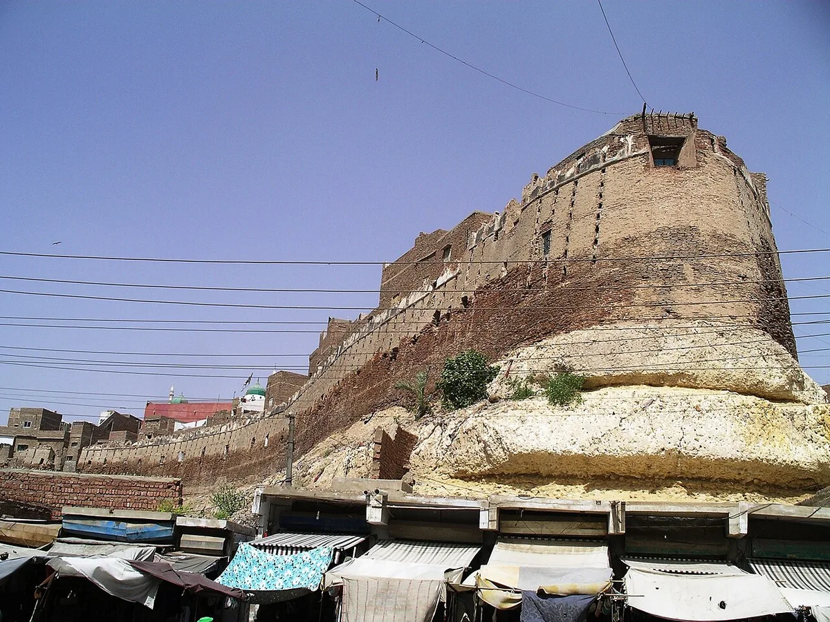
Kalhoro describes the hill as a plateau about 3.25 kilometres long and about 8 metres high. He says the fort sits at its southern end, so the steep face of the rock supports the outer wall. Photographs taken since 2003 show the same thing: the brick wall rises straight from a pale rock base, with market stalls along its foot.
Mian Ghulam Shah Kalhoro and the Founding of the Fort
Ghulam Shah belonged to the Kalhora dynasty of Sindh. Shazia Hasan, writing in Dawn in 2015, says his rule began in 1757, when the Kalhora chiefs chose him in place of his elder brother. Sindh was then part of Ahmad Shah Durrani’s Afghan empire. Before Hyderabad, the Kalhora capital was at Khudabad, south of present Dadu.
Why the Capital Moved from Khudabad
Sources give two related reasons for the move. The 2014 Dawn feature says “it is said” that constant floods at Khudabad frustrated Ghulam Shah, so he decided in the late 1760s to shift his capital. Zulfiqar Ali Kalhoro writes that he left Khudabad “possibly due to shifting away of the River Indus”. Both point to the river, but one blames floods and the other a change of course.
Britannica says Ghulam Shah named the new city after Ali, the son in law of the Prophet Muhammad, who was also called Haidar. Hence the name Hyderabad, the city of Haidar.
The Hill of Ganjo Takkar and Old Nerun Kot
The local name of the hill was Ganji, which Dawn translates as “bald” or “barren”. A 2018 paper by Koshalya Bai Punhani and Sindhu Chandio of the Sindh culture department gives the fuller name Ganjo Takkar and translates it as “the barren hill”.
Many writers say the city was built over an older town called Nerun Kot. Britannica states that Hyderabad was founded “on the site of the ancient town of Nīrun Kot”. The 1911 edition of the same encyclopaedia went further and said the old town “is supposed to have stood” on the site of the present fort. The Dawn feature traces the old fishing village to the Mauryan era.
Not every scholar agrees. The 2025 Joyo study compared Hyderabad’s forts with Ranikot Fort and read the descriptions of Nerun Kot in the Chach Nama and the Tarikh e Mazhar Shah Jahani. Those texts speak of a stone fort with a clear spring in hilly ground near Sehwan. The authors argue that this fits Ranikot, not Hyderabad. The question is still open.
Who Built the Fort and in Which Year
Dawn reports a tradition that the work was supervised by Diwan Gidumal, a courtier who was given “two boats full of money” and stayed near the site until it was done. The same feature says the building was finished in 1768. Dawn presents this as a tradition, using the words “is said to have been headed by”.
Most sources agree on 1768. These include the Sindh Antiquities Department, Zulfiqar Ali Kalhoro, The News on Sunday and Dawn’s news reports. Britannica is the exception. Its entry lists among Hyderabad’s antiquities “a fort (built 1782)” and gives no further detail. Readers should note that the year 1782 does not appear in the other sources used here.
Ghulam Shah did not live long in his new capital. Dawn’s 2014 feature says he died suddenly around 1771 to 1772, and that his death began the decline of Kalhora rule. His mausoleum still stands in Hyderabad. Shazia Hasan called it the oldest building in the city in 2015 and warned that it badly needed conservation.
The Fort Under the Talpur Mirs of Sindh
The Kalhoras lost power to the Talpurs, a Baloch tribe that had served in their army. The deciding fight was the Battle of Halani. Here the sources differ by one year. The 2014 Dawn feature dates it to 1782, while a 2021 Dawn news report and The News on Sunday give 1783. Both agree that Mir Fateh Ali Khan Talpur led the winning side. The story of the dynasty is told in our article on the Talpur dynasty and the Mirs of Sindh.
Mir Fateh Ali Khan Moves His Court Here
At first the new rulers did not use the fort as their capital. Dawn says Fateh Ali ruled from Khudabad until the Indus, which was changing its course, flooded it. After that Hyderabad became the capital again.
The Sindh Antiquities Department gives the year as 1789. In that year, it says, Mir Fateh Ali Khan abandoned Khudabad near Hala, made the fort his home and put up buildings inside it for himself and his relatives. The department adds that mosques were built inside the fort in both the Kalhora and Talpur periods.
Dawn calls the Talpur years the fort’s peak, when new buildings were added and old ones repaired. The Mirs’ buildings slowly filled most of the space inside the walls. Punhani and Chandio write that working class families also crowded into the fort in this period.
Palaces, Courts and the Mir Haram
The best known Talpur building is the Mir Haram, the ladies’ quarters. Dawn and The News on Sunday both say it was built during the rule of Mir Fateh Ali Khan.
According to The News on Sunday, the grandest building in the fort was raised by Mir Nasir Khan, who held his court there. Its Diwan e Khas had painted pillars and ceilings, with scenes of Rustam and Sohrab and portraits of the Mir’s court. The Diwan e Aam stood in the same building. The paper quotes James Burnes, a British doctor who visited around 1830, on the painted walls, the coloured carpets and the green silk curtains of the court.
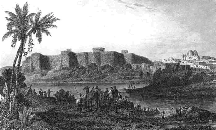
British writers who saw the fort before or soon after the conquest left more details. The Dawn feature quotes Richard Burton, who wrote that the fort was “at once the place of defence, the treasury, and the residence of the native rulers”. It also quotes J. H. W. Hall’s Scenes in a Soldier’s Life (1848). Hall saw nearly 1,800 houses inside the walls, some of them palaces. He also saw a very tall tower climbed by 76 steps, with four large Persian guns at the top.
The Battle of Miani and the British Takeover in 1843
By the early 1840s the East India Company had pressed a series of treaties on the Mirs. In a paper in the journal Pakistan Horizon, former police chief Aftab Nabi describes how General Charles Napier pushed for war in 1842 and 1843. The Talpur army that met him was gathered at short notice and lacked training and a clear chain of command.
The Battle of Miani was fought on 17 February 1843 on the bank of the Phuleli canal near Hyderabad. Napier had about 2,800 men and 12 guns. Nabi notes that the figures for the Baloch force and its losses vary widely between accounts. British writers at the time claimed that some 20,000 men took part, while later researchers estimated 10,000 to 12,000.
The Union Jack Over the Fort
The day after the battle, several of the leading Mirs surrendered. Nabi writes that Napier occupied Hyderabad on 20 February 1843, and that the British colours were raised over the city that day. The News on Sunday says a British party with horsemen, soldiers and two cannons entered the fort on 20 February and hoisted the flag.
The Sindh Antiquities Department notes that a memorial stands in one corner of the fort to a local soldier who bravely faced the British attack in 1843.
The fighting did not end at Miani. Napier defeated Mir Sher Muhammad Talpur near Hyderabad on 24 March 1843, in the battle known as Dubba (Nabi spells it Doabba), which is also called the Battle of Hyderabad. The captured Mirs were sent as prisoners to Bombay. Nabi cites a written complaint by Mir Nasir Khan, which claimed the plunder taken from the family was worth nearly 18 crore rupees. Britannica records that the capital of Sindh was then moved from Hyderabad to Karachi.
Clearing the Palaces and Building an Arsenal
The sources agree that the British cleared most of the Talpur buildings, but they differ on when. Dawn’s 2014 feature says the fort was badly damaged in the conquest and that most buildings were later razed. The spared buildings became British offices, and the tall towers were pulled down so they could not be used in any future uprising.
The Sindh Antiquities Department dates the clearance to 1857. It says the British then used the fort for troops, military stores and an arsenal. The 1911 Encyclopaedia Britannica adds that the provincial arsenal was moved there from Karachi in 1861. It also noted that the fort, covering 36 acres, still held “the palaces of the ex mirs of Sind”.
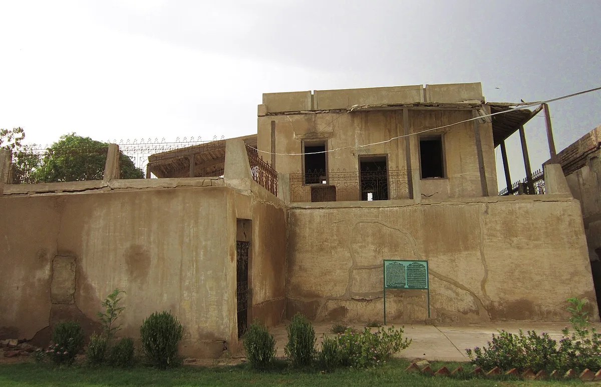
One building shows how the uses changed over time. In 2014 Dawn reported on an old structure inside the fort that once belonged to the Mirs. Under British rule it was turned into an army camp. After independence it held a revenue office. It later passed to the federal archaeology department, and then to the Sindh culture department after the 18th Amendment.
Architecture of the Pakka Qila Walls and Gates
The most visible part of the fort today is its outer wall. Zulfiqar Ali Kalhoro calls this wall the fort’s “unique feature”.
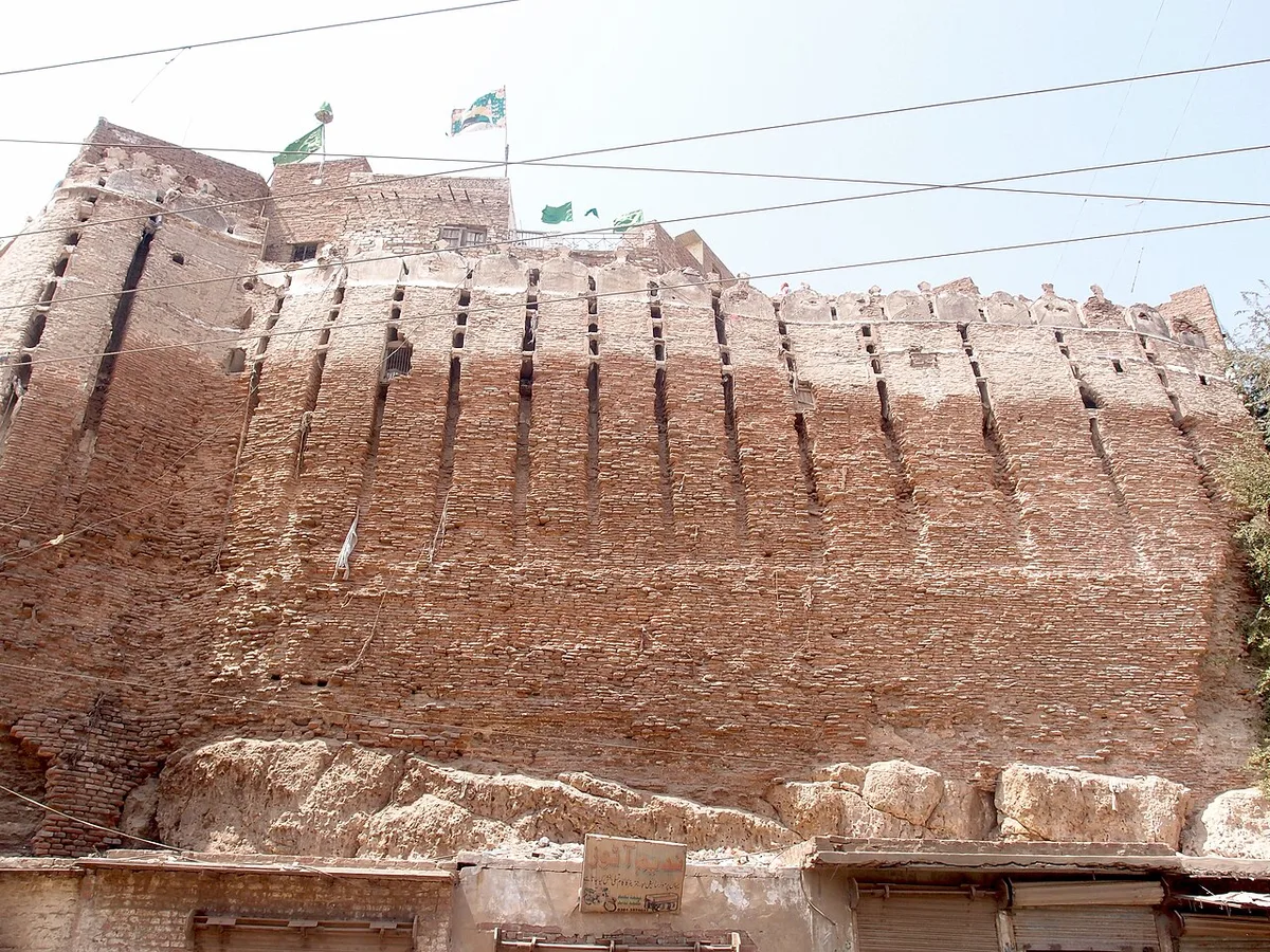
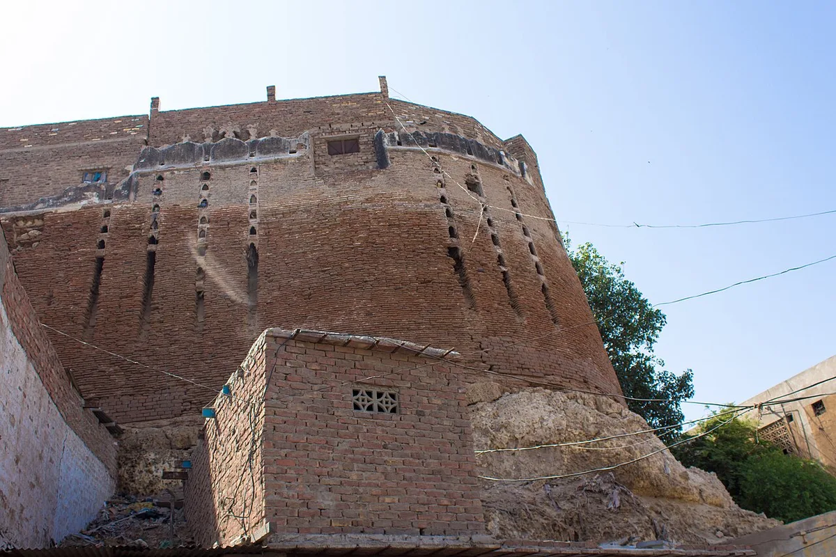
Richard Burton gave a close description in his book Sind Revisited (1877), quoted by The News on Sunday. He called the plan an irregular oval. The walls, he wrote, were tall facings of poorly baked brick, thick at the base and thinner above, resting against earth piled on the natural rock. He saw no angles and no outworks, only round towers built into the wall and a few openings for large guns. Burton thought it one of the weakest of the strong looking fortresses he knew.
Size of the Fort in Different Records
The size of the fort is given very differently. Burton and the 1911 Britannica give about 36 acres, and The News on Sunday repeats this figure. The 2014 Dawn feature gives 33 acres, and Punhani and Chandio give about 30 acres.
Official records do not match either. A Dawn report from January 2023 quoted Sindhu Chandio of the culture department. She said the Hyderabad Municipal Corporation’s records show the fort on 16 acres, while the archaeology department’s records put it at just over 38 acres. A survey was announced to settle the true area.
The wall height also varies between sources. Kalhoro gives 12 to 15 metres, and The News on Sunday gives 80 feet. The Joyo study measured heights of 20 to 50 feet and wall thickness of 3 to 5 feet.
Accounts of the length around the walls differ even more. Burton put it at about three quarters of a mile, while Kalhoro gives more than 2.25 kilometres. Most writers describe the shape as oval, but the Joyo study and the paper by Punhani and Chandio call it rectangular.
Bastions, Merlons and the Wall Openings
The Joyo study counted eight rounded bastions, some of them damaged. It found one main gate and one secret gate. Kalhoro, however, says the fort has two gates on the north. The 2014 Dawn feature describes the old gate on the west, facing the entrance of the Shahi Bazaar.
The Sindh Antiquities Department draws attention to the top of the wall. Its crest carries ornamental kanguras, or merlons, which the department calls “of a very curious shape”. Burton wrote that this Persian style battlement was meant to shelter men armed with matchlocks.
Burton also noticed long slits running down the face of the wall. He said they served as both drains and loopholes, and that the Persians called them “nostrils”. Rows of narrow vertical openings of this kind still show in recent photographs of the wall, such as the one below.
The Joyo study adds that the fort once had water reservoirs, which have since been destroyed. It found no wells or springs inside the walls.
Buildings That Survive Inside the Walls
Very little of the Talpur fort is left. The Sindh Antiquities Department lists the Mir Haram and a few walls of the building known as the record office as the only other remains of the Mirs’ period. It describes the Haram as “profusely decorated with painting though not of good taste”.
The state of the Mir Haram is itself disputed. Dawn in 2014 said it “still stands”. In 2021, however, The News on Sunday reported that it had been demolished during earlier repair work, leaving only a square courtyard. In the same year The Express Tribune reported that a conservation contract covered the fortification wall, the Mir Haram and the main gate.
The 2014 Dawn feature describes other remains. A large Talpur building was later used as a museum and still had faded murals at the top of its walls. Next to the Mir Haram stood a large wooden gate studded with metal spikes. To the east, a passage known locally as Qilay ki Surang, the fort’s tunnel, led to a grave and to tunnels that residents had sealed. The writer was also shown a tent shaped structure said to be a royal stable, but he could find no written record of it.
From Refugee Camp to Crowded Neighbourhood After 1947
The modern history of the fort began with Partition. Dawn’s 2014 feature says the authorities used it as a temporary camp for migrants from India, and that over time this camp became a shanty town.
In a 2020 report in The Express Tribune, archaeologist and former chief custodian Dr Kaleemullah Lashari described how this happened. Refugees first camped in the open spaces of the fort. Then they began to use the cellars inside the fort walls as shelter. “It was never meant to be a solution for the resettlement of the refugees,” he said, “but the situation dragged on for an undesirably long period.”
Lashari explained why this harms the structure. People have built kitchens and washrooms into the walls, and the heavy use of water has weakened them. As a result, he said, parts of the walls collapse often and have killed many people.
Nobody knows exactly how many people live inside. The same report quotes Sindh Culture Minister Syed Sardar Ali Shah as saying that more than 70,000 people live there, “like a whole city”. The minister also claimed that former prime minister Zulfikar Ali Bhutto gave the residents plots in Latifabad, but that they sold them and came back. Residents quoted in the report said they were too poor to buy homes elsewhere, and that their families had lived in the fort for generations.
A Dawn report from September 2021 noted that a government school and the Fort police station are also inside the walls. It said members of the Frontier Constabulary had lived there until recently.
Encroachment and Damage to the Protected Fort
The fort is a protected heritage site under the Antiquities Act, 1975. Dawn has reported that building is banned within 200 feet of the protected walls. Even so, the walls and the buffer zone have been damaged many times.
In 2014 Dawn reported that the provincial education department had pulled down most of the old colonial style building described above in order to build a school. The culture department’s archaeology director said the building itself was not protected, but that it lay inside the 200 foot buffer zone where no demolition was allowed.
The Wall Broken Down in Street Number One
A worse case followed in 2015. Dawn reported in January 2023 that a piece of the eastern fortification wall in Street No. 1 had been knocked down with heavy machines in June 2015 to create a building plot. The figures differ even in the same report. The culture department’s FIR spoke of 55 feet of wall, while an email from the deputy director of the time described a stone wall of about 50 feet.
In January 2023 the owner of the plot started building again, this time a plaza of ground plus five storeys. The Hyderabad deputy commissioner stopped the work. Dawn reported in May 2026 that the plot’s entry in the land record had been cancelled in August 2023.
The same May 2026 report describes another case in Street No. 1. A heritage building from 1939 caught fire on 3 May 2026. When firefighters and officials entered, they found trenches 10 to 12 feet deep dug inside it. The culture department recommended action against the owners under the Sindh Cultural Heritage (Preservation) Act, 1994.
The Collapse of the Main Gate in 2021
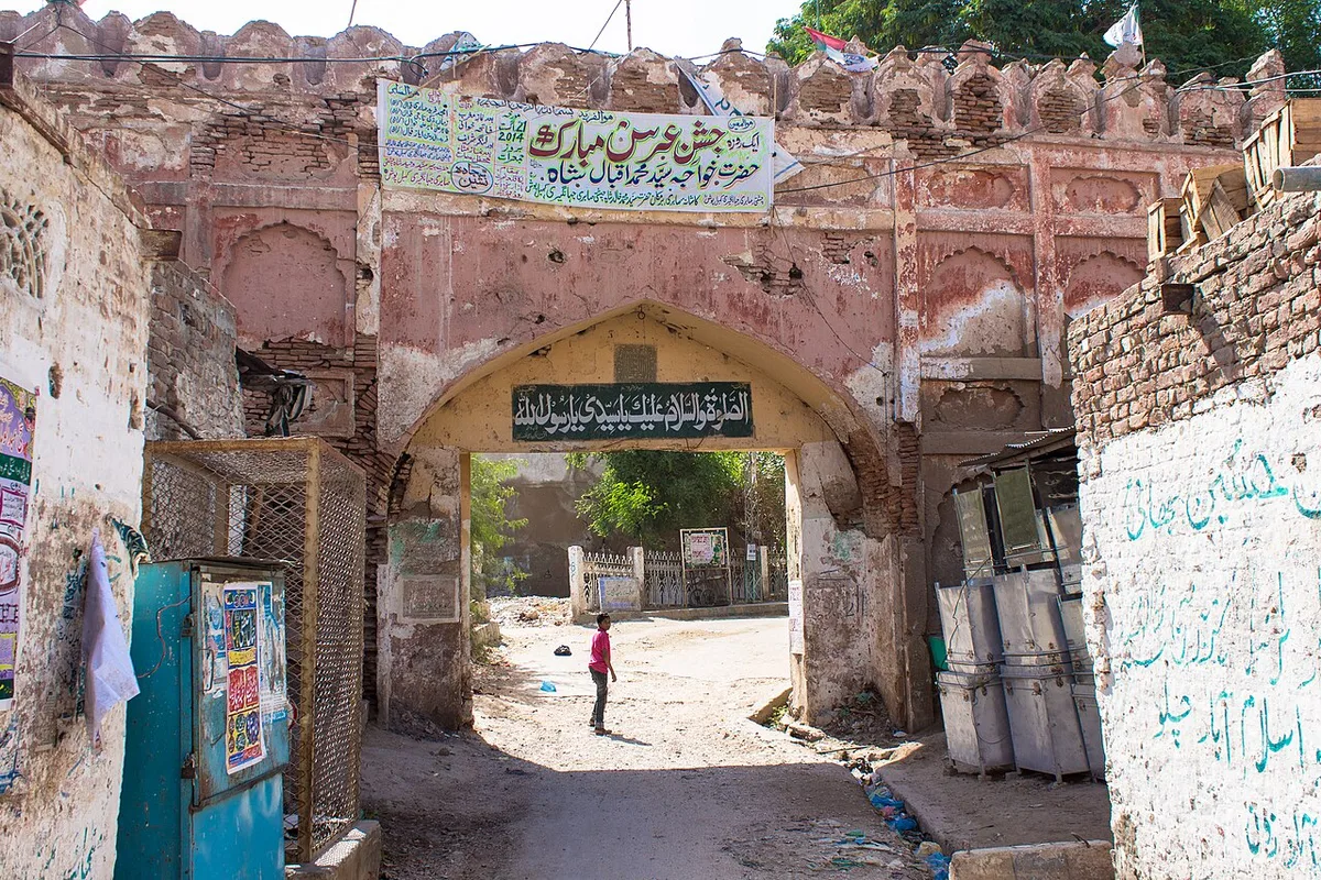
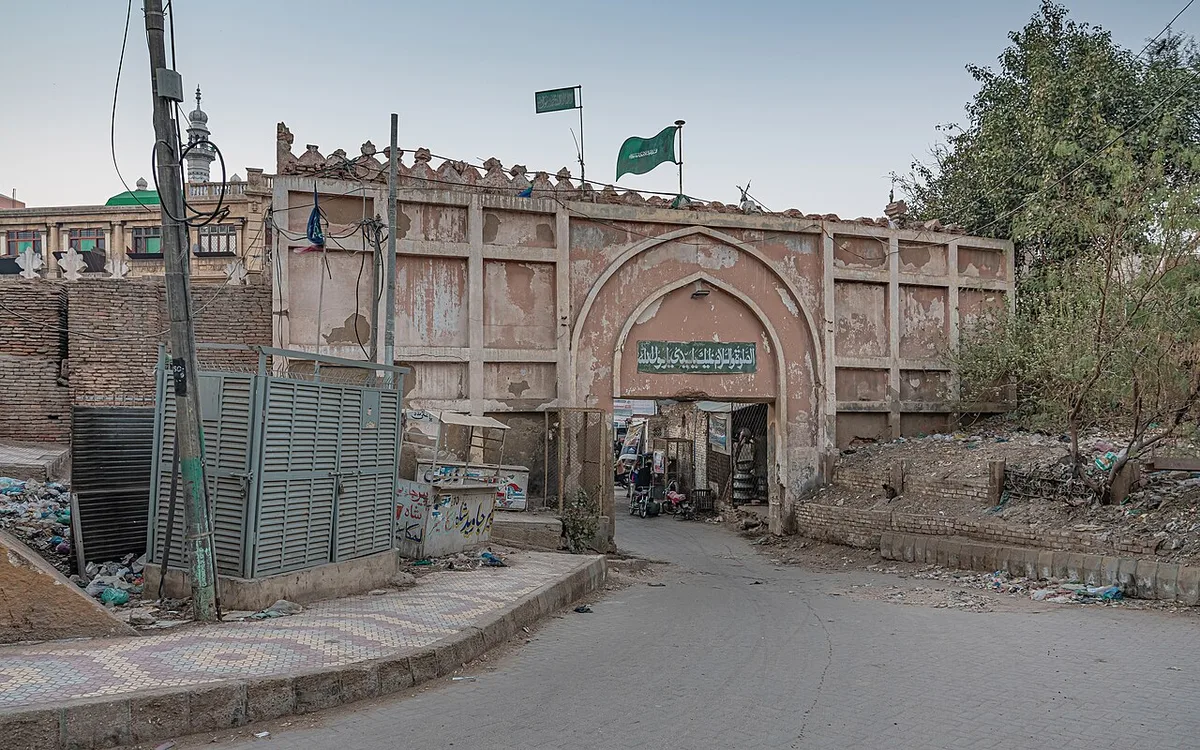
The most widely reported damage came from a repair job. On 2 September 2021, the front of the main gate collapsed at around noon during conservation work. Dawn reported that no one was hurt. Large sections of the wall on both sides of the gate also came down.
Labourers had been “underpinning” the wall, which means replacing salt damaged bricks one by one. A five member inquiry looked into the collapse. The Express Tribune reported its findings. The committee blamed the contractors for demolishing the wall joined to the gate, which caused cracks and then the fall. It said they had worked without proper advice from officials or archaeologists.
The inquiry also quoted a letter of 7 January 2021 from the resident engineer. He had warned that the gate was leaning 3 to 4 degrees outward and was dangerous for the public. The committee found that waste water from the whole fort ran through the foundation of the main gate and wall, which it called “a constant threat”. It asked for a new drainage system and for commercial encroachments along the wall to be removed. A case was registered against the contractors under the Antiquities Act.
Archaeologist and engineer Ishtiaq Ansari told The News on Sunday that old buildings must be repaired with their original materials. Mud should be used for mud, lime for lime, and bricks of the old size and shape. “It is not an unskilled man’s job,” he said.
Restoration Plans and Legal Protection for Pakka Qila
Several plans to save the fort have been made, but none has been completed. In 2014 Dawn reported that the Endowment Fund Trust for Preservation of the Heritage of Sindh was running a project on the Darbar Hall and the main gate of the fort.
The Express Tribune reported in 2020 on a larger scheme from the Sindh antiquities department. It would have built 350 apartments on municipal land near the fort and moved the residents there before careful conservation of the walls. The Provincial Development Working Party approved it and allotted funds. Later, however, the scheme was cut back to conserving selected parts of the fort and improving its entrance. Lashari said the work stopped after he was transferred.
The 2021 Dawn report on the collapse added that the culture department was short of staff and technical experts. It said the provincial government had often stated that the “political aspect” of the fort could not be ignored. Moving a large population would be part of any full restoration, and monsoon rains damage the walls every year.
The latest effort is legal rather than physical. In January 2026 the Hyderabad deputy commissioner formed a Heritage Protection Committee. In February 2026, Dawn reported that the committee had asked the Sindh Building Control Authority to stop approving building plans anywhere within the fort’s protected area without the consent of the Director General of Antiquities. It also asked for no building within 200 feet outside the boundary wall.
The same report says some parts of the fort have been declared a “red zone” because they are unsafe. The Hyderabad Municipal Corporation was asked to survey all shops and structures along the wall and record their owners. In March 2026 Dawn reported that officials had sealed a plot again after its occupant resumed building next to the protected wall.
Life in and Around the Pakka Qila Area Today
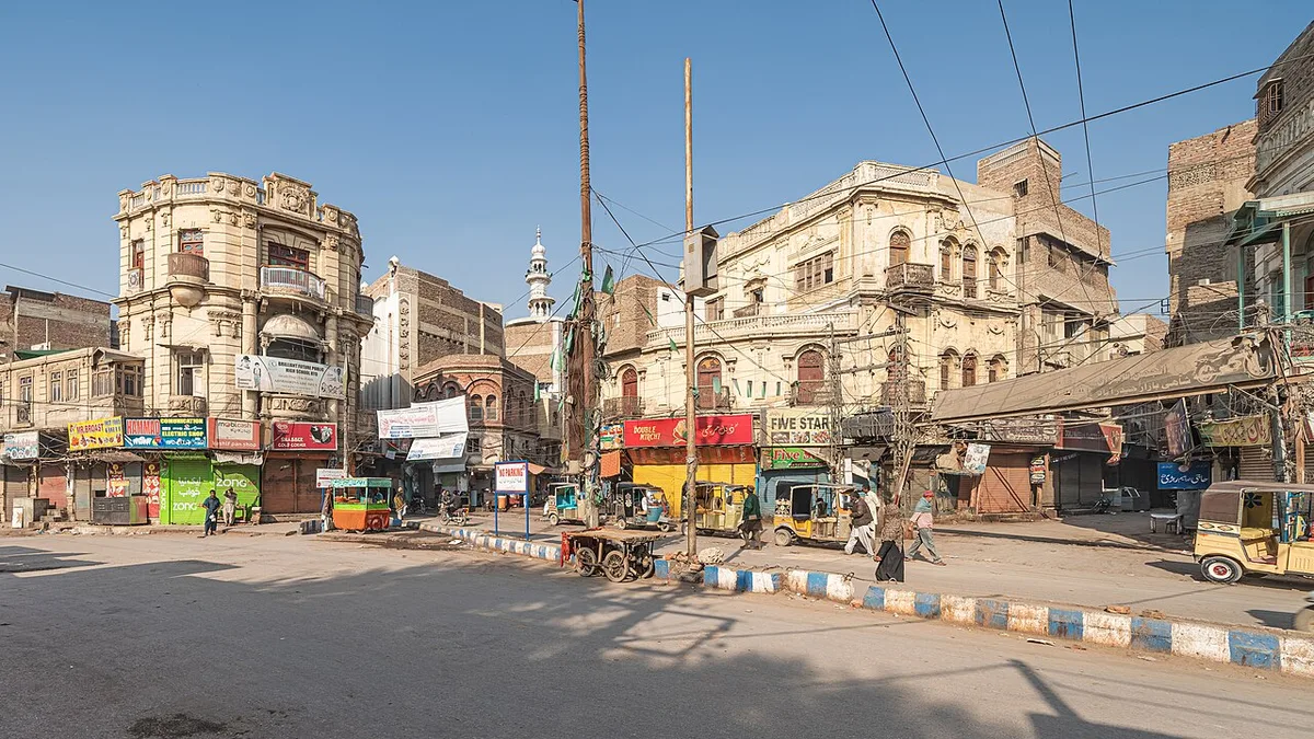
For many people in Hyderabad, the Qila is a neighbourhood as much as a monument. Dawn reported in 2021 that shops stand right outside the main entrance and that the wall is dotted with shops. Its May 2026 report adds that Street No. 1 has several heritage buildings from 1938 to 1940 in and around it.
The 1990 Police Operation in Pakka Qila
The fort is also linked with a painful event in recent history. On 26 and 27 May 1990, a police operation was carried out in the Pucca Qila area. The death toll is still disputed. The Express Tribune reported in 2017 that around 40 people were killed. Dawn in 2012 wrote that police fired on a procession led by women and children, killing more than 45 people and wounding 250.
The Muttahida Qaumi Movement still marks the anniversary. In 2017 the party repeated its demand for an independent inquiry. The Tribune reported that it said those responsible had never been brought to justice.
Visiting the Fort and Nearby Heritage
The Sindh Antiquities Department lists visiting hours of 8 am to 7 pm in summer and 9 am to 6 pm in winter. It also names a departmental representative at the site. Visitors should keep in mind that people live in much of the fort, and that some parts of the wall have been declared unsafe.
Hyderabad has more Kalhora and Talpur heritage close by. Britannica lists the tombs of the Kalhora and Talpur rulers and the palaces of the former Mirs among the city’s main antiquities. The city also has fine buildings from the early twentieth century, such as Mukhi House in Hyderabad.
Further afield, Britannica names Bhit Shah, near Hala, as a major historic site of the region. It holds the tomb of the poet Shah Abdul Latif Bhittai, who died in 1753. The two sites are linked through one man. Shazia Hasan’s 2015 Dawn article credits Ghulam Shah with building Bhittai’s mausoleum in 1762, six years before he built the fort on Ganjo Takkar.
Sources and Further Reading on the Fort
- Sindh Antiquities Department, “Boundary wall of Pucca Fort Hyderabad” (site page).
- Encyclopaedia Britannica, “Hyderabad, Pakistan”; and Encyclopaedia Britannica, 11th edition (1911), “Hyderabad (Sind)”.
- Syed Zeeshan Ahmed, “Crumbling majesty: The fascinating Pakka Qila”, Dawn, 19 November 2014.
- Dawn news reports on Pucca Qila: 3 and 5 September 2021, 19 January 2023, 25 February 2026, 7 March 2026 and 5 May 2026; and “Major part of historical building in Hyderabad fort demolished”, Dawn, July 2014.
- Shazia Hasan, “Kalhoro mausoleum: Where no one comes to offer fateha”, Dawn, 10 July 2015.
- Rabia Bugti and Filza Rizwan, “The forgotten fort of Hyderabad”, The Express Tribune, 14 March 2020.
- Z. Ali, “Pucca Qila probe faults contractor”, The Express Tribune, 6 September 2021; “MQM observes 27th anniversary of Pucca Qila tragedy”, The Express Tribune, May 2017.
- Akhtar Hafeez, “Fading glory”, The News on Sunday, 24 October 2021.
- Aftab Nabi, “The Battle of Miani and the Conquest of Sindh”, Pakistan Horizon.
- Amin Joyo, Badar Abro, Sarang Joyo and Babar Ali, “Revisiting the History of Sindh’s Forts”, Journal of History and Social Sciences 16 (4), 2025.
- Koshalya Bai Punhani and Sindhu Chandio, “History of Pacca Fort Hyderabad”, Engineering Science and Technology International Research Journal 2 (4), 2018.
- Zulfiqar Ali Kalhoro, Studies in Kalhora History, Economy and Architecture.
- “Deadly decades”, Dawn, 13 October 2012.

Leave a Comment