

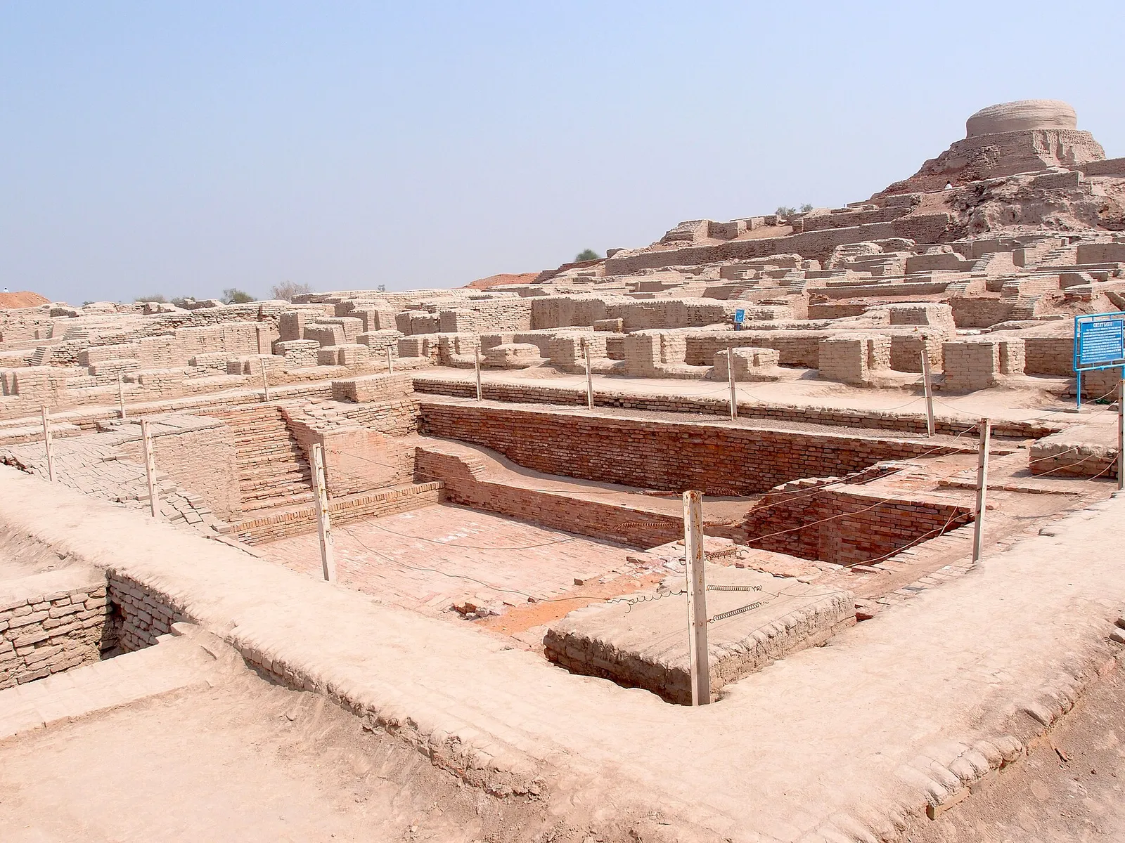
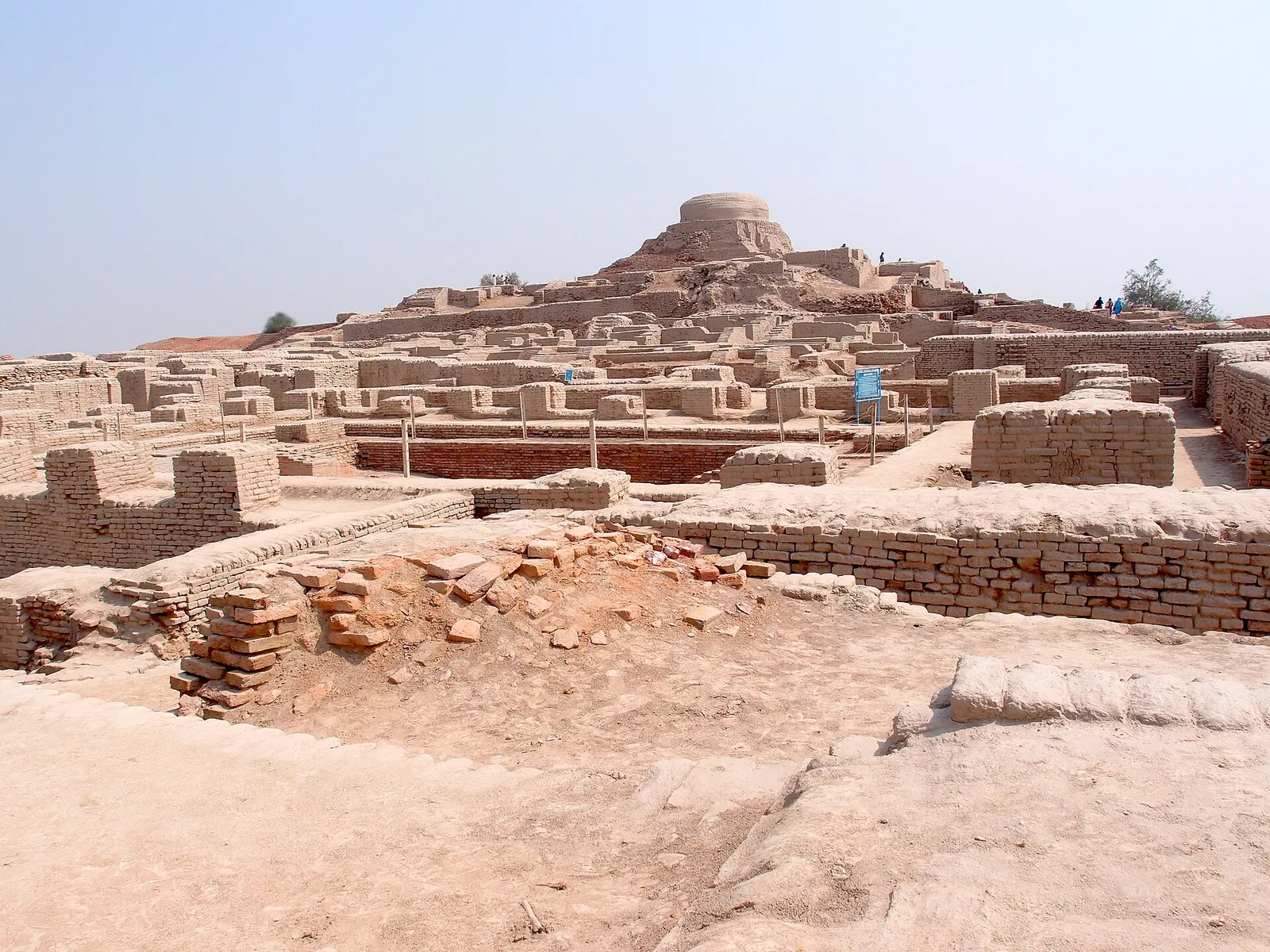
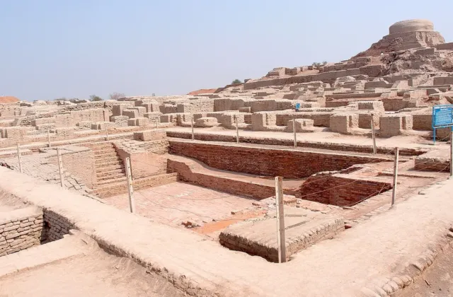
Drive some 28 kilometres south west of Larkana, and very soon the fields of sugarcane and rice give way to a low, brown mound a short distance from the right bank of the Indus. On top of this mound is an old, broken Buddhist stupa. All around and below the stupa lie the streets, houses, wells and drains of a city about as old as the pyramids of Giza. You may hear that it was already old when the pyramids were new, but really the two are about the same age. This is Mohenjo Daro, the best preserved city of the Indus Civilisation and among the earliest planned cities anywhere.
In this article (20)
- Mohenjo Daro at a Glance, Key Facts
- How Mohenjo Daro Was Discovered
- The Citadel and the Great Bath
- The Planned Lower Town and Its Streets
- Drains and Water Management in the City
- Seals, script and famous objects
- The Buddhist Stupa on the Citadel Mound
- Who ran the city, and why did it decline?
- Saving the Ruins of Mohenjo Daro
- Planning a Trip to Mohenjo Daro
- Why Mohenjo Daro Matters Today
- Frequently Asked Questions About Mohenjo Daro
- Where is Mohenjo Daro in Sindh?
- What does the name Mohenjo Daro mean?
- How old is the city of Mohenjo Daro?
- Who discovered Mohenjo Daro?
- Has the Indus script been deciphered?
- Can I see the Priest King at Mohenjo Daro?
- Related Reading on PakSindh About Sindh
- Sources and Further Reading on Mohenjo Daro
The name is Sindhi (Moen jo Daro) and the meaning is generally given as “Mound of the Dead”. The original name of the city remains a mystery, as the script of its people has yet to be deciphered. Everything that we know about the site has come from around one hundred years of excavation and research. In this guide we set out what archaeologists have actually established, and where the popular story goes further than the evidence.
Mohenjo Daro at a Glance, Key Facts
| Location | Larkana District, Sindh, near the right (west) bank of the Indus, roughly 28 km from Larkana city |
| Period | Mature Indus (Harappan) period, about 2500 to 1900 BCE |
| Size | Protected area of about 240 hectares. About 100 hectares are visible today. |
| Discovered | 1922, by R. D. Banerji of the Archaeological Survey of India |
| Main areas | The raised “Citadel” mound in the west (Great Bath, Great Hall, stupa) and the Lower Town in the east |
| Famous finds | The “Priest King” figure (National Museum of Pakistan, Karachi), the bronze “Dancing Girl” (National Museum, New Delhi), hundreds of inscribed seals |
| Status | UNESCO World Heritage Site since 1980, listed as “Archaeological Ruins at Moenjodaro” |
How Mohenjo Daro Was Discovered
For centuries the mound was known locally only because of the Buddhist stupa on its top. In 1922, R. D. Banerji, an officer of the Archaeological Survey of India, visited this stupa to study it. After digging under it, he found flint tools and seals which were far more ancient than anything Buddhist. Seals of the same type had been discovered earlier at Harappa in Punjab, and the two finds together revealed a whole civilisation that had been completely forgotten.
A major excavation campaign was carried out during the 1920s under Sir John Marshall. Ernest Mackay excavated large sections of the Lower Town between 1927 and 1931. Mortimer Wheeler excavated on the Citadel in 1950, while an American team headed by George Dales worked at the site in 1964 and 1965. After that, the work slowly changed from digging to survey and conservation, which is probably for the best. A German research project from 1982 to 1984 mapped the standing remains in detail and showed that the city is built on massive artificial platforms of mud brick and compact earth.
The Citadel and the Great Bath
The western mound, otherwise known as the Citadel, lies on a massive raised platform high above the surrounding plain. This helped to protect the buildings there from the floods of the Indus, and also set them apart from the rest of the city. The first thing most visitors walk to is the Great Bath, which was uncovered in 1926.
The Great Bath is a rectangular reservoir about 12 metres long, 7 metres across and 2.4 metres deep. Access to the Great Bath is provided from the north and south sides through flights of steps. The floor and walls are constructed from bricks set on edge and joined together very closely in gypsum mortar, with a thick layer of bitumen behind them to prevent leakage. The corner of the bath has a drain to take away the waste water. Also, there is a room nearby with a well which may have supplied water to it. It is often described as the earliest public water tank of the ancient world.
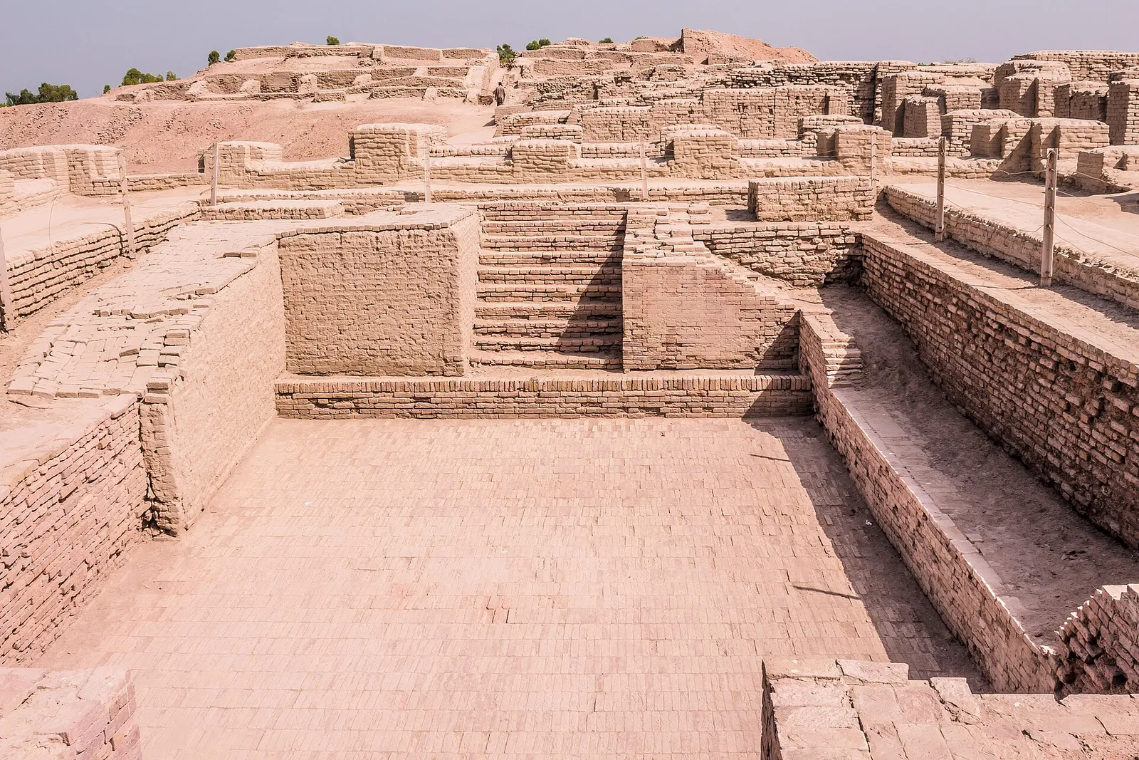
What the Bath was used for, no one can say with certainty. A popular idea among scholars is ritual bathing or purification. This purpose would also be consistent with the significance of water in the later religions of South Asia. But there is no inscription to explain it, so if a guide at the site tells you priests bathed here, that is only a guess.
It is also true of the other structures on the Citadel. Wheeler called the large structure to the west of the Bath a “Granary”, but modern day archaeologists often use the name “Great Hall”, because there is no clear evidence that this building was actually used for storing grain. The “College” and the pillared “Assembly Hall” are two other examples of such names given by early excavators, not based on anything found inside.
The Planned Lower Town and Its Streets
The Lower Town lies to the east of the Citadel, and mostly ordinary people lived and worked there. The main roads of the city run roughly north to south or east to west, thus dividing the city into large blocks, with small lanes leading to private houses. The layout of the city is considered by UNESCO as evidence of an early system of town planning, laid out “according to strict rules”. It is said that around 40,000 people may have lived here at its peak, though this is only a rough estimate.
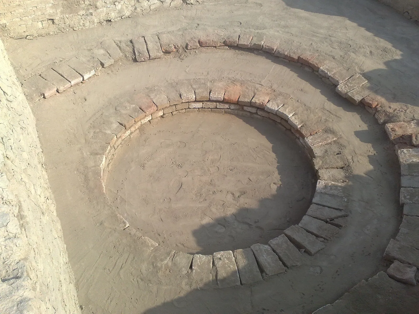
The buildings were constructed using fired bricks of standard proportions. Many of these houses contained a central courtyard with rooms surrounding it, along with stairs leading to an upper storey or even the roof. Some houses even included bathing platforms that drained water through sloping floors, and some had private wells. The archaeologists estimate there being several hundred wells in Mohenjo Daro, which is incredible for an ancient town.
Drains and Water Management in the City
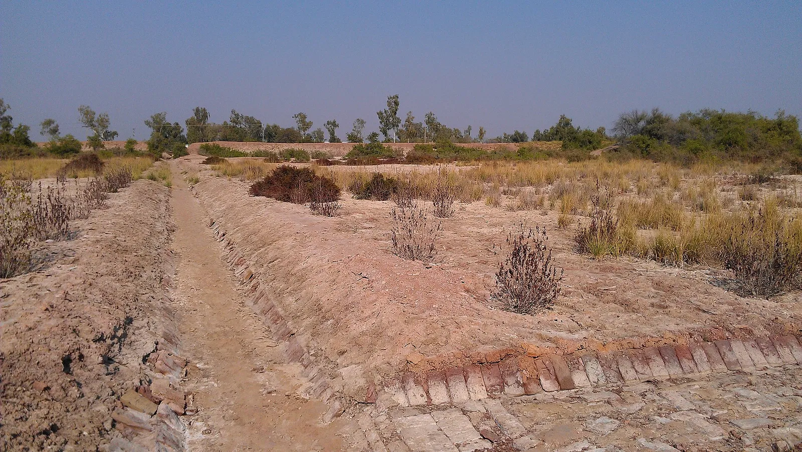
Drainage was what people loved about the Lower Town most. Waste water flowed through chutes into covered drains made of bricks along the streets. The drains had inspection points through which they were cleaned. Few other cities had similar systems, and it took a long time for others to catch up.
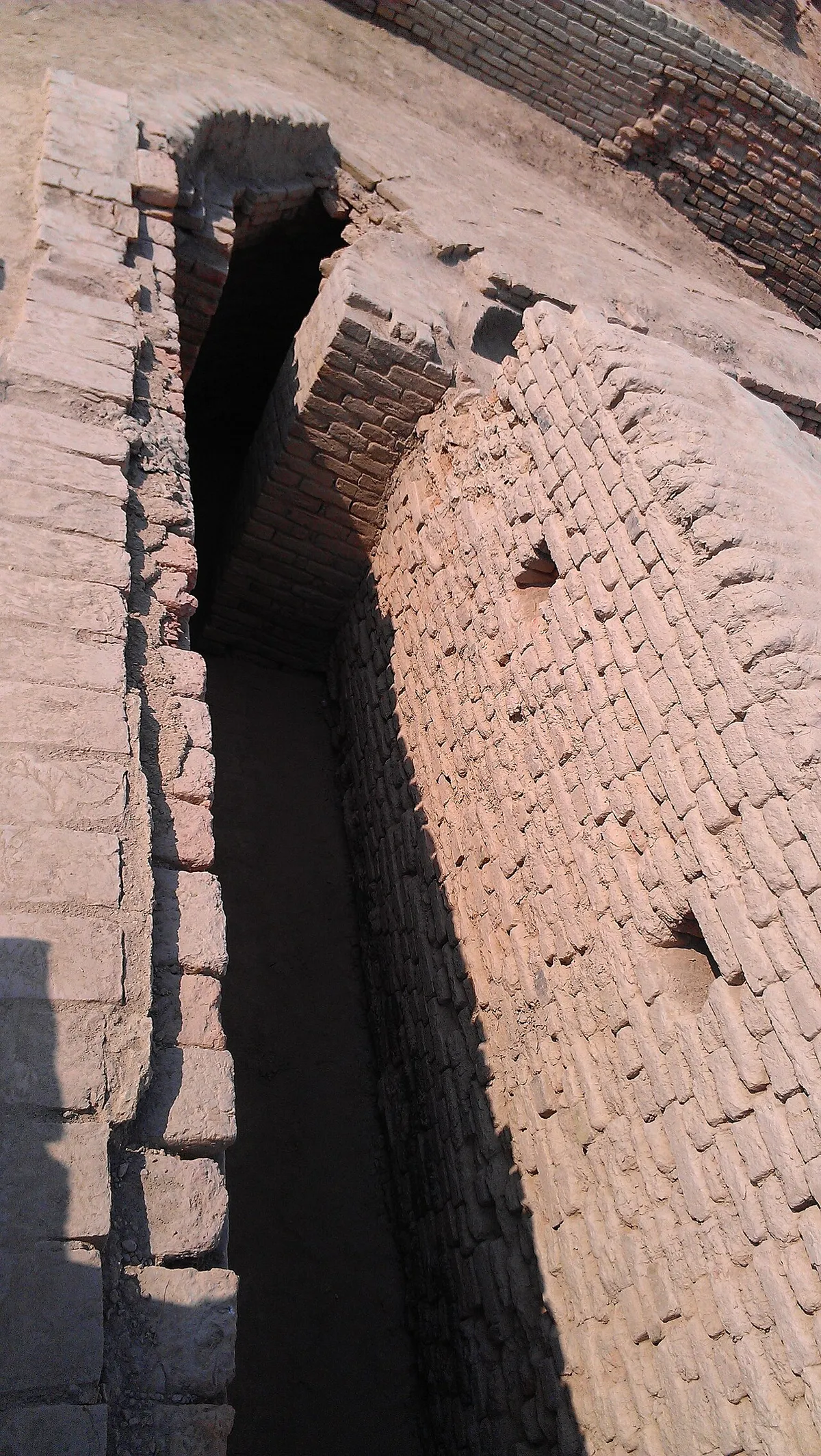
Taken together, the wells, bathing areas and drains show that the builders treated clean water and sanitation as a shared, public problem. This is one reason why Mohenjo Daro is so often cited in discussions of the history of town planning.
Seals, script and famous objects
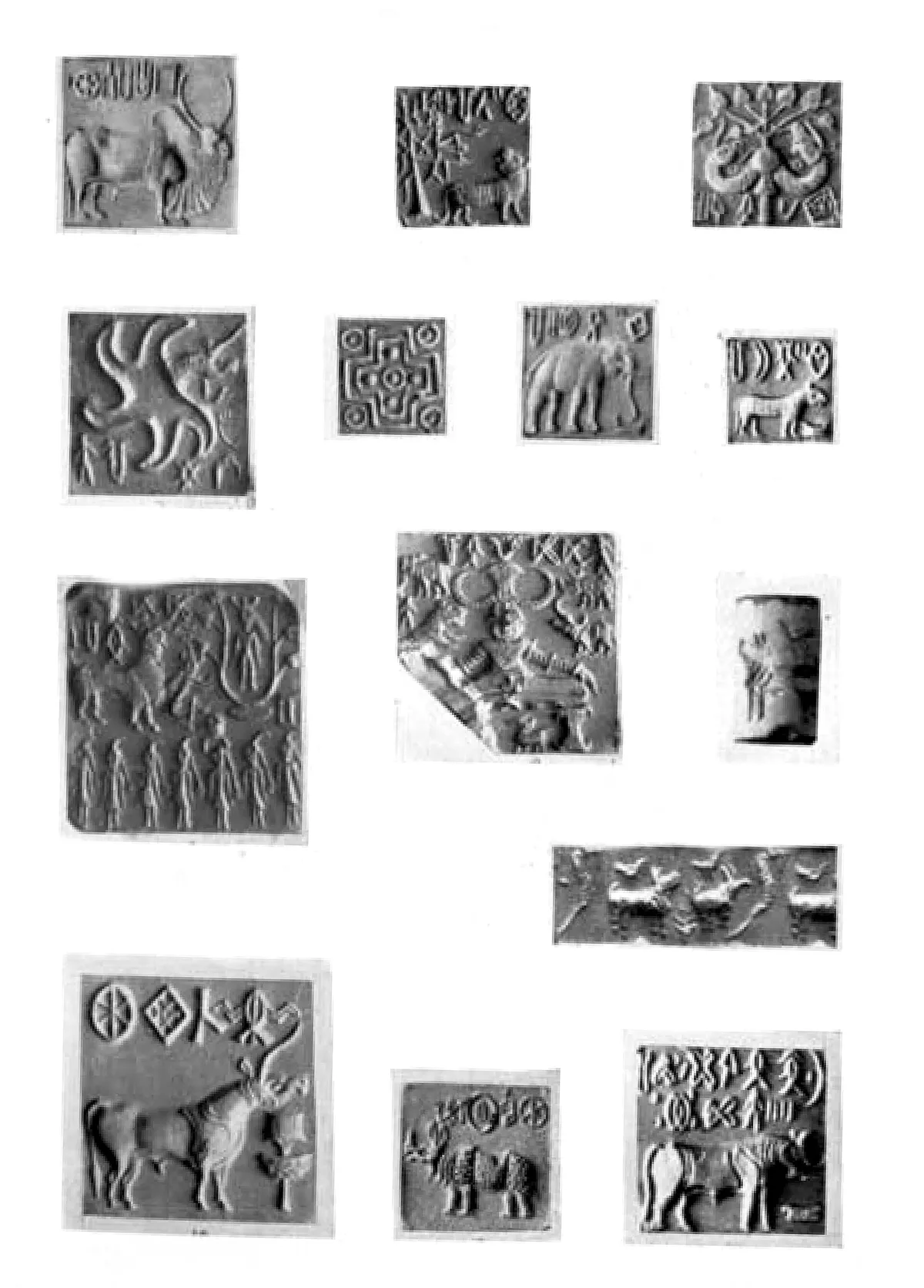
Hundreds of small square seals, usually made of steatite, were discovered by archaeologists. The majority of them show an animal, either a humped bull or a one horned “unicorn”, under a short line of symbols that represents the Indus script. Several hundred different symbols are known, but the inscriptions are very short, and no bilingual text has ever been found. Therefore, despite many attempts, the script has never been deciphered, and this is why we cannot name the city’s rulers or read its own account of itself.
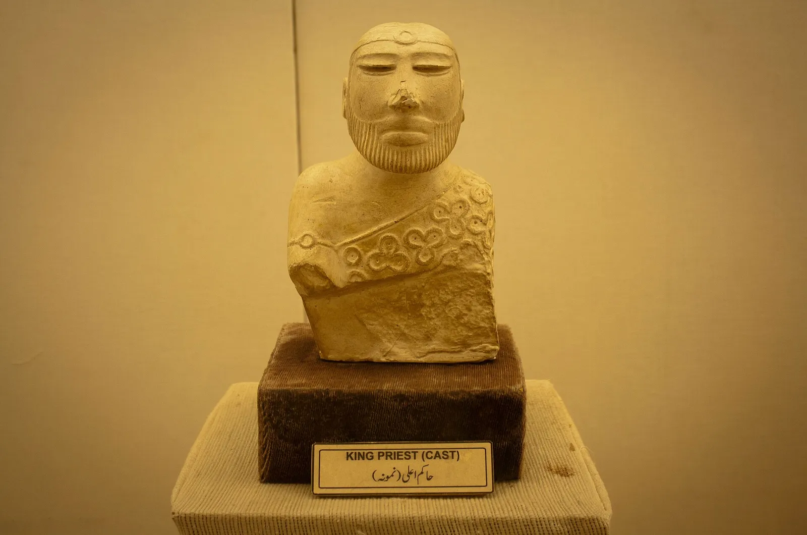
Two well known objects from Mohenjo Daro are the Priest King and the Dancing Girl. The Priest King is a small figure carved from soapstone (steatite). It shows a man with a beard and a robe covered in trefoils, a three lobed leaf shape. It is currently housed at the National Museum of Pakistan, Karachi. The Dancing Girl is a bronze figure of a young woman around 10 cm high, discovered in 1926, which is housed at the National Museum in New Delhi. Neither name is ancient; modern scholars named them, and nobody knows whether he held religious or royal power, or whether the woman was a dancer.
Large sculpture is rare at Mohenjo Daro. Most finds are small: figures, seals and pottery. There are no giant statues of kings here.
The Buddhist Stupa on the Citadel Mound
The stupa that stands at the topmost part of the Citadel is not part of the Indus city. It was erected long after the city was abandoned, around the 2nd century CE, when Buddhism flourished in the region, and coins from the Kushan era have been found nearby. This shows that the mound was occupied again some two thousand years after the Indus city had been abandoned. Without it, Banerji would probably never have come here to dig in 1922.
Who ran the city, and why did it decline?
There is something unusual about Mohenjo Daro. It lacks any obvious royal palace, grand temple or monuments glorifying a king. Someone made sure that bricks, weights and measures were the same from one end of the Indus region to the other, yet who held that power is still argued over. The suggestions include a single ruling elite or councils of merchants or religious leaders.
From about 1900 BCE, the city began its decline. Building standards fell and there appears to have been a gradual departure of the inhabitants. Wheeler made popular a dramatic older theory that Aryan invaders swept in and destroyed the city. George Dales challenged this theory in 1964, and today most archaeologists reject this idea. Currently, a number of factors are seen to account for the city’s decline: shifts in the courses of rivers, changes in climate and the decline of long distance trade.
Saving the Ruins of Mohenjo Daro
After the ruins were exposed, they started to suffer. Salt rising from the groundwater crystallises in the bricks, causing them to crumble, while the floods of the Indus have threatened the site again and again. In the 1970s and 1980s, UNESCO ran an international campaign to save Mohenjo Daro, and in 1989 large spurs were built in the bed of the river to stabilise the bank. Conservation work continues, and new excavation has been kept to a minimum. Much of the city still lies unexcavated beneath the surrounding fields, and honestly, that may be the safest place for it.
Planning a Trip to Mohenjo Daro
- Larkana is roughly half an hour away by car, and that is how most people come. There is an airport, Moenjodaro Airport, right beside the site, but flights are few, so the road from Larkana or Sukkur is the normal route. If you are coming from Karachi, you will cover more than 400 km, so plan to spend at least one night on the way.
- Go between October and March if you can. Summers in upper Sindh are extreme and there is very little shade among the ruins.
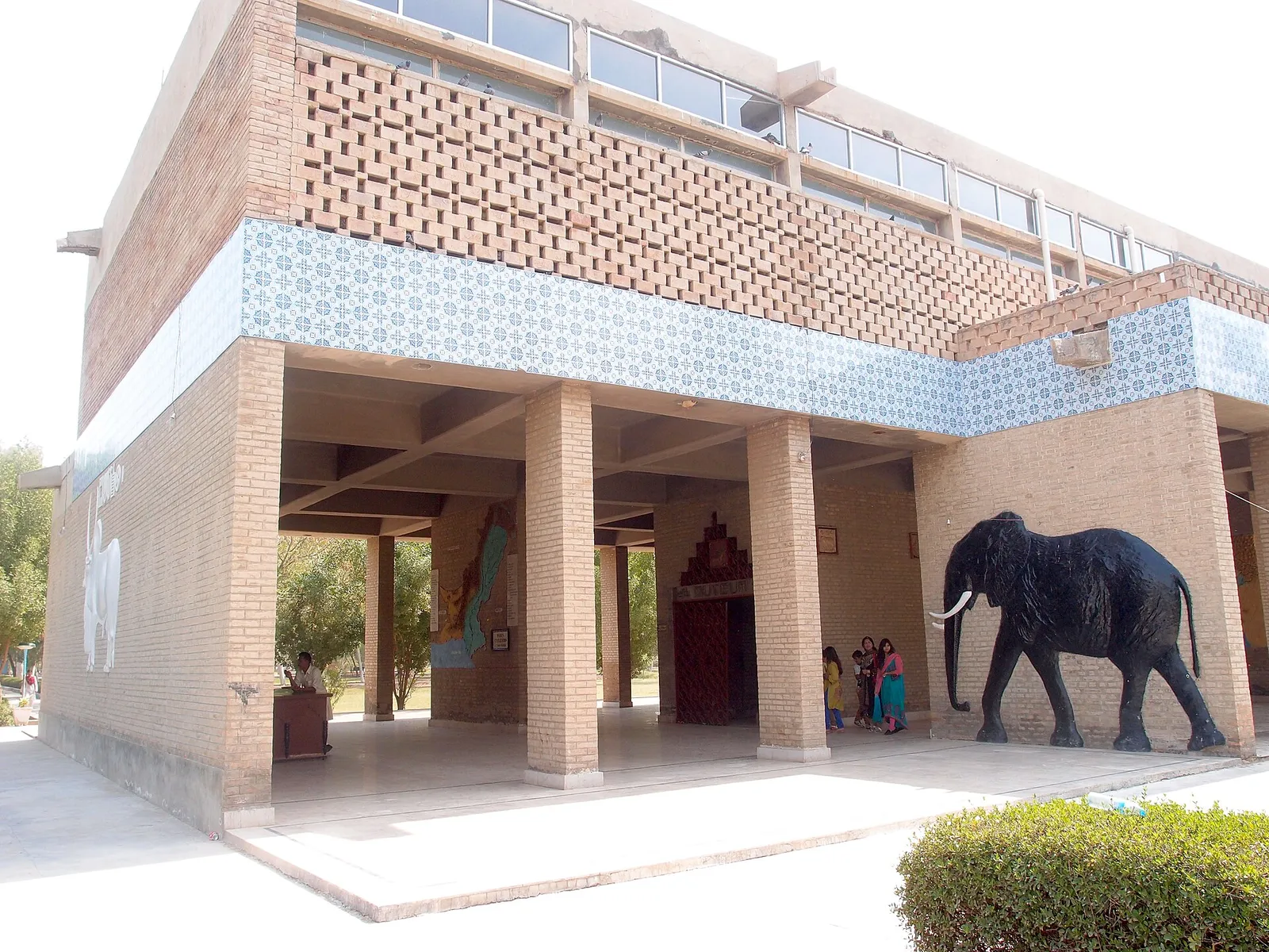
- There is a museum at the site with seals, pots, tools and replica objects. Visit it first before heading to the ruins, because things will make much more sense to you afterwards.
- Take at least half a day for the museum, the Citadel with the Great Bath and stupa, and part of the Lower Town.
- Ticket prices and opening hours get revised every so often. Check locally or with the Sindh Culture, Tourism, Antiquities and Archives Department before you travel.
- Be sure to carry a water bottle, a hat, sunblock and good footwear. The walk between the Citadel and the Lower Town is farther than it appears from the entrance.
- Don’t climb the walls or carry off bricks and bits of pottery as souvenirs, and stay out of fragile structures. The ruins are a protected World Heritage Site.
Why Mohenjo Daro Matters Today
More than four thousand years ago, the people of Sindh built a large city with planned streets, standard bricks, private bathrooms and public drains. Mohenjo Daro gives one of the clearest glimpses we have into the Indus Civilisation, one of the three great early civilisations of the Old World, alongside Egypt and Mesopotamia. We still cannot read its writing or say who its rulers were. This is precisely why, for us in Sindh, looking after the site is as important as knowing its history.
Frequently Asked Questions About Mohenjo Daro
Where is Mohenjo Daro in Sindh?
In Larkana District, Sindh. The ruins sit near the right (west) bank of the Indus, roughly 28 km from Larkana city.
What does the name Mohenjo Daro mean?
It is Sindhi for “Mound of the Dead”, at least in the usual translation. That is a modern local name, though. What the builders called their city is unknown, since nobody can read their script.
How old is the city of Mohenjo Daro?
The city flourished from about 2500 to 1900 BCE, in what archaeologists call the Mature Indus (Harappan) period. The Buddhist stupa on top came much later, around the 2nd century CE.
Who discovered Mohenjo Daro?
R. D. Banerji of the Archaeological Survey of India, in 1922. He came to study the stupa and found Indus seals underneath it. John Marshall and Ernest Mackay then led the big excavations.
Has the Indus script been deciphered?
Not yet. The inscriptions are short and there is no bilingual text to work from, so every attempt so far has failed.
Can I see the Priest King at Mohenjo Daro?
Not the original. That is in the National Museum of Pakistan in Karachi. The site museum has seals, pottery, tools and replicas, so ask locally what is on display when you go.
Related Reading on PakSindh About Sindh
- Kot Diji Fort and the ancient site below it
- Ranikot Fort, the “Great Wall of Sindh”
- Makli Necropolis at Thatta
- Sindhi Ajrak: history and designs
- Mukhi House Hyderabad, history and museum
Sources and Further Reading on Mohenjo Daro
- UNESCO World Heritage Centre, “Archaeological Ruins at Moenjodaro” (inscribed 1980). whc.unesco.org/en/list/138
- John Marshall (ed.), Mohenjo Daro and the Indus Civilization, 3 vols, London: Arthur Probsthain, 1931.
- E. J. H. Mackay, Further Excavations at Mohenjo Daro (excavations of 1927 to 1931), New Delhi: Government of India, 1938. archive.org
- Michael Jansen, “Architectural measurements in the Indus cities: the case study of Mohenjo-Daro”, Cambridge University Press, 2010. doi.org/10.1017/cbo9780511760822.015
- George F. Dales, “The Mythical Massacre at Mohenjo Daro”, Expedition 6(3), 1964.
- Jonathan Mark Kenoyer, Ancient Cities of the Indus Valley Civilization, Karachi: Oxford University Press, 1998.
- Encyclopaedia Britannica, “Mohenjo Daro”. britannica.com
- “Mohenjo Daro” and “Great Bath of Mohenjo Daro”, Wikipedia. en.wikipedia.org/wiki/Mohenjo Daro, en.wikipedia.org/wiki/Great_Bath_of_Mohenjo Daro
Photo credits: Featured image (the Great Bath and the Great Hall mound) by Saqib Qayyum, CC BY-SA 3.0, via Wikimedia Commons. Other photos are credited in their captions.

Leave a Comment