

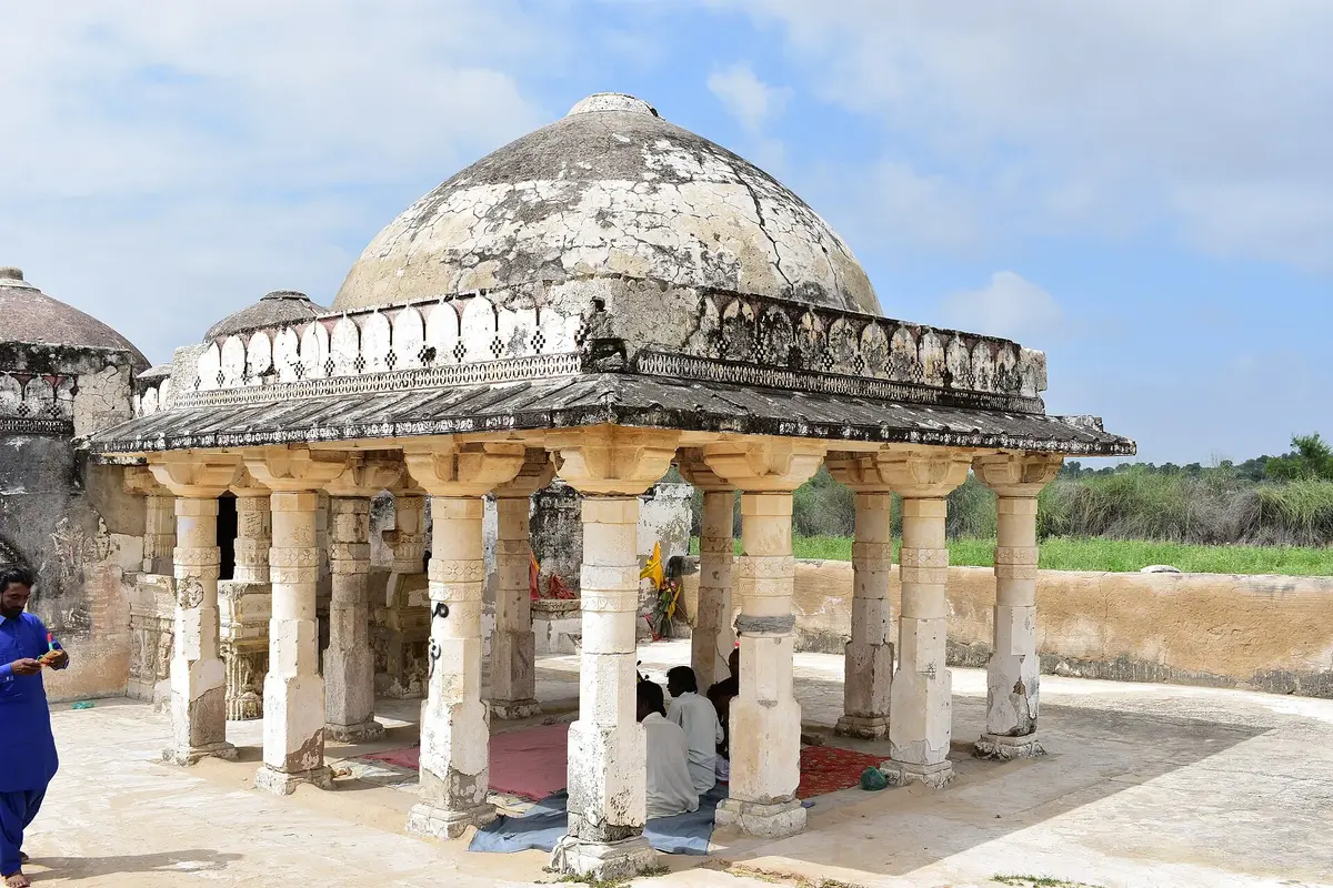
Some places in Pakistan you visit for the view. Tharparkar is one of those places where the stories matter just as much. Umerkot has the tale of Marvi, the village girl who refused the riches of a king, and it is also the town where the Mughal emperor Akbar was born in 1542. Mithi gave the country Mai Bhagi, whose folk songs went from Thari villages to Radio Pakistan and PTV. And near Nagarparkar, marble Jain temples still stand in a landscape that was once close to the sea.
In this article (35)
- Tharparkar at a Glance
- Where the Name Tharparkar Comes From
- Umerkot Fort, a Key Centre of Sindh’s History
- The Museum Inside Umerkot Fort
- Umar Marvi, the Story That Made Umerkot Famous
- Akbar’s Birthplace in Umerkot
- Naukot Fort, the Gateway to Thar
- Mithi, a Town Known for Religious Harmony
- Mai Bhagi and the Folk Music of Thar
- Daily Life and Traditional Culture in Thar
- Homes Built for the Desert
- Dress, Colour and Crafts
- Water, Livestock and Food
- Old Trucks and Transport Across the Desert
- Peacocks, Wildlife and the Monsoon in Thar
- Nagarparkar, Karoonjhar and the Jain Heritage of Parkar
- Gori Mandir, a Fine Example of Jain Architecture
- Frescoes and Stone Carving at Gori Mandir
- The History of Gori Mandir and the Damage It Suffered
- Virawah and Its Ancient Sea Trade
- Artwork of the Virawah Temples
- Bhodesar, Where a Temple and a Mosque Share One Style
- Nagarparkar and UNESCO World Heritage
- Planning a Trip Through Tharparkar
- Preserving the Heritage of Tharparkar
- Final Thoughts
- Frequently Asked Questions
- What is Tharparkar famous for?
- Was Akbar really born in Umerkot?
- How old is Gori Mandir?
- Is Nagarparkar a UNESCO World Heritage Site?
- Who was Mai Bhagi?
- When should I go to Tharparkar?
- Related Reading on PakSindh
- Sources and Further Reading
This guide follows Tharparkar history and culture in the order most travellers meet it on the road. It begins at Umerkot Fort and Akbar’s birthplace, moves on to the Talpur era Naukot Fort, stops in Mithi, and ends among the Jain temples of Nagarparkar, Virawah and Bhodesar at the foot of the Karoonjhar Mountains. Along the way it covers the music of Mai Bhagi, the old desert trucks, village life, wildlife, and the reasons UNESCO placed the Nagarparkar landscape on its Tentative List.
Our elders left us more than land and buildings. They left folk songs, embroidery, recipes, traditional dress and a long habit of living peacefully with neighbours of other faiths. Learning about that inheritance, protecting it and passing it on to the next generation is the responsibility of our generation, and a journey through Tharparkar makes that responsibility very easy to feel.
Tharparkar at a Glance
| Location | South eastern Sindh, bordering Rajasthan and Gujarat in India |
|---|---|
| District headquarters | Mithi |
| Area | About 19,637 square kilometres, the largest district in Sindh |
| Population | 1,778,407 (2023 census) |
| Main languages | Dhatki (Thari) and Sindhi, with Marwari and Gujarati influences in Parkar |
| Key landmarks | Umerkot Fort, Naukot Fort, Gadhi Bhit in Mithi, Karoonjhar Mountains, Gori Mandir, Virawah temples, Bhodesar Mosque |
| Best time to visit | November to February for cool weather, July to September for green monsoon scenery |
Where the Name Tharparkar Comes From
Tharparkar is really two words and two landscapes. Thar means the sandy desert, its dunes, thorn bushes and villages of round huts. Parkar is the rocky area around Nagarparkar in the far south east, where granite hills rise out of the flat ground. Elders explain Parkar as “the land across”, because people once had to cross the water and salt flats of the Rann of Kutch to reach it.
The British set up the Eastern Sindh Frontier District here in 1860, and from 1901 to 1947 it was called Thar and Parkar. Today Tharparkar is the largest district in Sindh, with Mithi as its headquarters and about 1.78 million people according to the 2023 census. Umerkot became a separate district later on, but in Thar everyone still thinks of it as the doorway to the desert, so that is where our journey starts.
One fact surprises most visitors: Thar is among the most densely populated deserts on earth. For centuries families have survived here by saving rainwater in ponds and underground tanks, herding goats, sheep, cattle and camels, and sowing millet, guar and moong whenever the monsoon is generous.
Umerkot Fort, a Key Centre of Sindh’s History
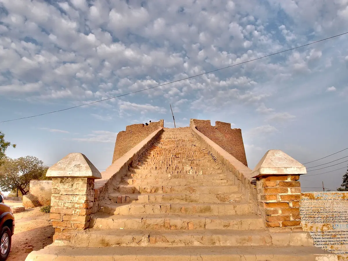
Umerkot is one of the oldest towns of Sindh, and its fort sits right in the middle of it, wrapped in brick walls and round bastions. Many accounts say it was founded by Rana Amar Singh of the Sodha Rajputs, which is why the town was long known as Amarkot. Other traditions connect the early fort with the Samma and Soomra periods. Whatever the exact beginning, the fort has changed hands many times since.
Soomras, Sammas, the Sodha Ranas, the Kalhoras, the Talpurs and finally the British all held Umerkot at different times, and each left a mark on its politics. Go up the central tower. A few old cannons still sit up there, aimed at nothing in particular now, and from that height it is easy to see why everyone wanted this fort. You can even make out the line where the green fields end and the sand begins.
The Museum Inside Umerkot Fort
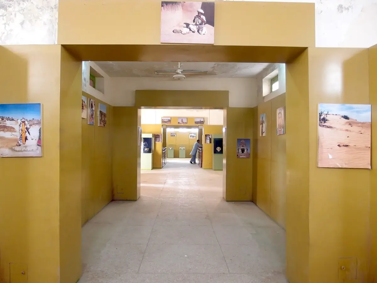
Do not skip the small museum inside the fort. Its rooms hold traditional clothing, silver jewellery, swords and shields, old coins, manuscripts and royal decrees, known as farmans, from the Mughal period. A few Jain statues dug up near Virawah in Nagarparkar ended up here too, which is a nice coincidence, because Virawah is where this trip ends.
It is more than a room full of old objects. Take your time in there. A rusty sword or a faded farman says more about old Sindh than a whole chapter in a textbook.
Umar Marvi, the Story That Made Umerkot Famous
Ask anyone in Sindh about Umerkot and sooner or later they will mention Marvi. In Sindhi literature and folklore she stands for love, loyalty and devotion to one’s homeland.
Marvi was a young woman from Malir, a village in Thar, and she was engaged to a man named Khet. Umar Soomro, the ruler of Umerkot, heard of her beauty and had her carried off while she was drawing water at a well. He kept her in his fort and offered her silk, gold, jewels and the life of a queen. Marvi refused all of it. She kept wearing her rough village clothes, longed for her own people and their simple food, and would not give up her promise to Khet. In the end Umar could not change her heart, and he sent her home with respect.
Shah Abdul Latif Bhittai gave the tale a permanent place in Sindhi poetry through Sur Marvi in his Shah Jo Risalo. In his verses Marvi becomes a symbol of freedom and of a person who will not trade her watan, her homeland, for comfort. You can read more about the poet in our guide to Shah Abdul Latif Bhittai and Shah Jo Risalo.
Parts of the story are presented inside the fort through the museum and cultural displays, and many travellers also visit Bhalwa village in Tharparkar, where a well is linked with Marvi’s abduction.
The countryside around Umerkot tells its own story. On one side lies the Thar Desert, while on the other side canal water has turned the land into green fields of cotton, wheat and vegetables. Men and women often work side by side in these fields, and if you stop by the road you will see how farming, folk songs and old customs still shape everyday life here.
Akbar’s Birthplace in Umerkot
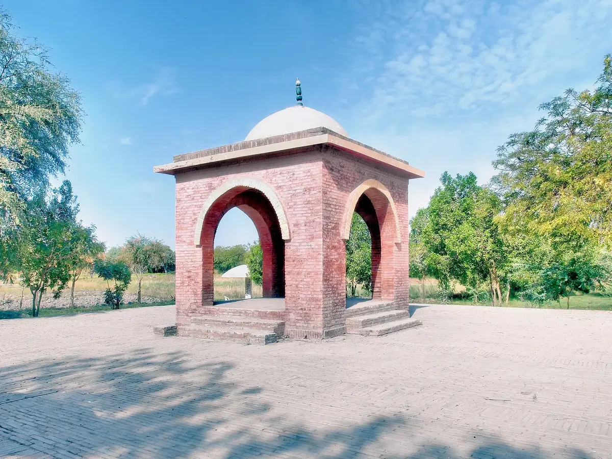
Umerkot holds another surprise. Akbar, often called the greatest of the Mughal emperors, was born here.
In 1540 the Mughal emperor Humayun was defeated by Sher Shah Suri at the Battle of Kannauj and lost his throne. He wandered towards Sindh looking for allies. While in Sindh he met Hamida Banu Begum, and the two were married in 1541. When Humayun reached Umerkot, the Sodha ruler Rana Prasad gave him and his small party shelter. On 15 October 1542 Hamida Banu gave birth to a son there. That child became Akbar the Great.
Today a small memorial stands at the spot, not far from the fort. Most people drive right past it. Stop anyway. Few places make it so clear that big history, the kind that changed the whole subcontinent, once passed through a small town in Sindh.
Naukot Fort, the Gateway to Thar
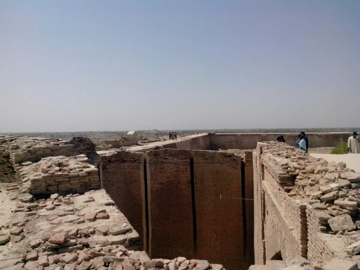
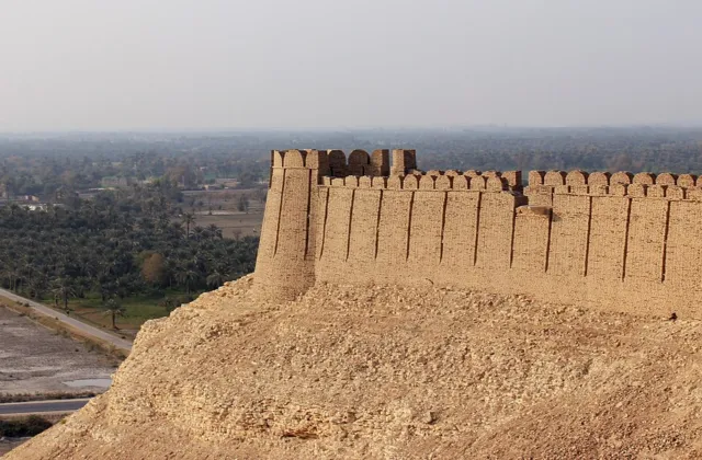
Drive about 75 kilometres from Umerkot, towards Mithi, and the brick walls of Naukot appear beside the road. Thari people call this little town the gateway to Thar, and honestly the name fits; once you pass it, the fields thin out and the sand takes over.
The fort was built in 1814 by Mir Karam Ali Khan Talpur. Why here? Raiders from the Rajput states kept slipping across the eastern frontier, and the Talpurs wanted a strong post to stop them. The masons worked only with burnt brick and mud mortar (no timber, no iron) and enclosed an area of roughly 113 by 98 metres. My favourite detail is the entrance. You cannot just walk in; you squeeze through a narrow, bending passage flanked by two huge half round bastions, which forced any attacker to slow down right beneath the defenders.
Inside, a wide courtyard is ringed by living quarters and small rooms. Some were stores, and the guides in Naukot will tell you a few held prisoners. The British took the fort in 1843 when they conquered Sindh. Today it is in the hands of the Sindh government, and rainwater pooling inside remains its biggest enemy. (If the Talpur period interests you, our article on the Talpur dynasty and the Mirs of Sindh tells the whole story.)
A small plea to every visitor. Names scratched into plaster and bricks pried loose for souvenirs have scarred far too many monuments in Sindh already. These walls were laid by hand over two hundred years ago. Look after them, or our children will only ever meet Naukot in a schoolbook.
Mithi, a Town Known for Religious Harmony
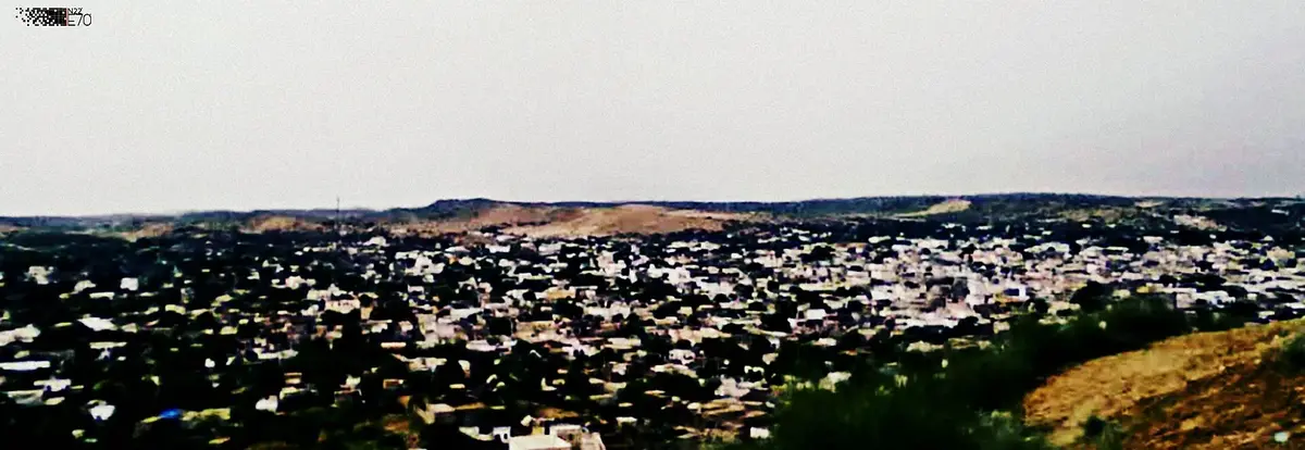
Keep driving south and you get to Mithi, the district headquarters. It is a quiet, friendly place, and it has a reputation across Pakistan for one thing in particular. Hindus and Muslims here have lived as neighbours for generations, and they genuinely seem to like it that way.
Eid, Diwali and Holi are everybody’s festivals in Mithi. People drop by each other’s houses with mithai and turn up at each other’s weddings. In Muharram, Hindu families set up stalls of water and sherbet for the mourners. Many Muslim families here, for their part, do not slaughter cows, simply out of regard for the people next door. None of this is official policy. It is just how Mithi has always done things.
You’ll notice different faiths all over town and across the district. At the Gurdwara Guru Nanak Sahib the langar is open to all. Walk in hungry and nobody asks your name or your religion before handing you a plate. That is equality you can actually taste.
Before you leave, climb Gadhi Bhit, the big sand hill at the edge of town, around sunset. The whole of Mithi goes gold below you, and suddenly it makes sense why people here never want to live anywhere else. What holds Thar together is not religion alone. It is Dhatki, the local language, plus the same clothes, the same food, the same songs and the same old customs.
Mai Bhagi and the Folk Music of Thar
No conversation about Tharparkar is complete without its folk songs, and no name is more loved in Thari music than Mai Bhagi.
She was born Bhag Bhari around 1920 in the Mithi area, near Diplo, into a family of singers. Her father, Wanhyun Fakir, and her mother, Khadija Manganhar, were both known for their voices. At sixteen she married the folk singer Hothi Fakir, and in 1950 she settled in Mithi. Her break came at Radio Pakistan Hyderabad, where she first sang “Khari Neem Ke Neeche” around 1960, reportedly for a fee of just twenty rupees. When she performed the same song on PTV in 1974, it became a national hit. She later received the Pride of Performance in 1981, and she kept singing until her death on 7 July 1986.
Her songs carried the emotions of Thar to the rest of the world: love, separation, waiting for rain and the small joys and sorrows of daily life. In the villages you can still hear similar music played on the murli, the gourd flute often linked with snake charmers, the chang, or jaw harp, and the dholak, accompanied by clapping hands. Musician families such as the Manganhars have kept these tunes alive for centuries.
The worrying part is that fewer people are learning it. Phones blast film songs now, and plenty of boys in Thar know more Bollywood than Bhagi. Folk music matters for more than its melody. It holds the language, history, feelings and social customs of a place. If young people pick up these songs again, and if we actually pay local singers to perform, this music has a real chance of coming back.
Daily Life and Traditional Culture in Thar
Forts and temples tell part of the story. To understand Tharparkar properly, watch how people live.
Homes Built for the Desert
Most traditional homes are chaunras, round huts with thick mud walls and cone shaped roofs of grass laid over wooden poles. They look modest, yet they stay cool on a June afternoon and hold warmth on a January night. Before a wedding or Diwali, women smear the walls with fresh clay and paint patterns around the door with their fingers.
Dress, Colour and Crafts
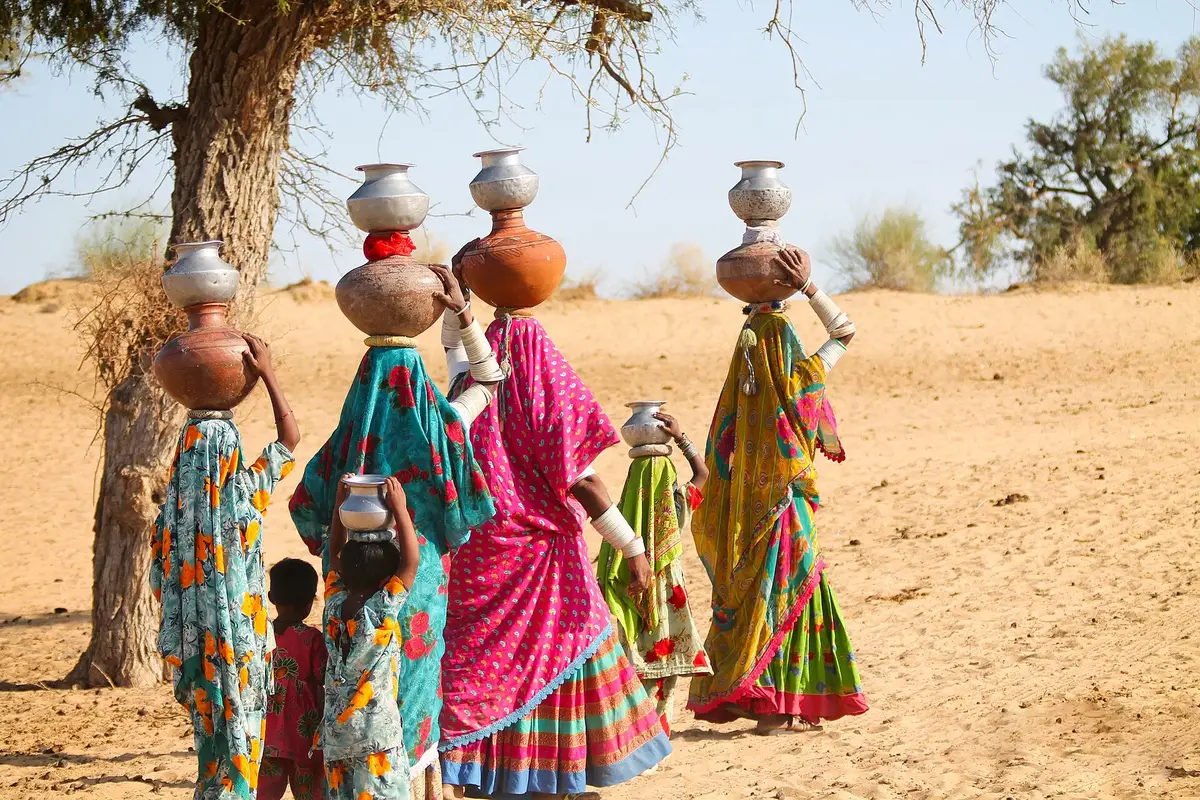
Thari women wear some of the brightest clothes in Pakistan: full skirts, embroidered blouses and big shawls in red, saffron, yellow and green. In some communities a married woman’s arms are covered in white bangles from wrist to shoulder. Thar is also famous for rilli (patchwork quilts), mirror work, fine embroidery and woollen rugs woven by hand. Our guides to Sindhi bharat embroidery and the history of Sindhi Ajrak show how these crafts connect with the rest of Sindh.
Water, Livestock and Food
Water rules life in Thar. In many villages women still walk a long way every morning with pots stacked on their heads to draw water from deep wells. A family’s real wealth is its goats, sheep, cows and camels, which is why one failed monsoon can ruin a household for a year. Food is plain and filling: millet roti with buttermilk, lentils and whatever vegetables are in season. After good rain, wild greens and mushrooms sprout across the sand and whole families go out to gather them.
Old Trucks and Transport Across the Desert
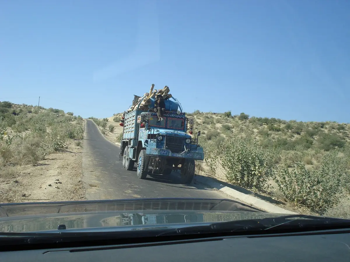
One of the more unusual parts of Thar culture is its fleet of old trucks. For decades these big, noisy machines with oversized tyres were the only thing that could get across the dunes without getting stuck. Locally they are often called kekra. They carry passengers on the roof, goats in the back and sacks of grain and building material wherever they are needed.
Camel carts and donkey carts still do the shorter trips between villages. There are good roads now between Mithi, Islamkot and Nagarparkar. Head off into the villages, though, and you will still be riding on a kekra. They deserve a place in the story of Tharparkar as much as any fort, because they are part of how people here have survived and stayed connected.
Peacocks, Wildlife and the Monsoon in Thar
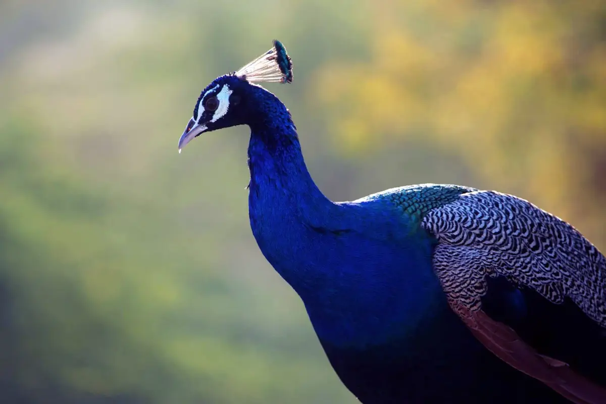
You will see peacocks almost everywhere in Thar, perched on walls, pecking around courtyards, calling at dawn. Villagers treat them as part of the family and hardly anyone would harm one. In bad years Newcastle disease (Ranikhet, as people here call it) has wiped out many birds, so the vaccination drives run by wildlife officials really matter. Watch for chinkara gazelles and desert foxes too.
Then the monsoon arrives, usually in July, and Thar becomes another place. Within a week the brown sand is covered in grass, ponds brim with water, herders drive their animals out to graze and the peacocks open their tails. Village singers bring out their old rain songs. It is hot and humid, true, yet from July to September the desert is at its loveliest.
Nagarparkar, Karoonjhar and the Jain Heritage of Parkar
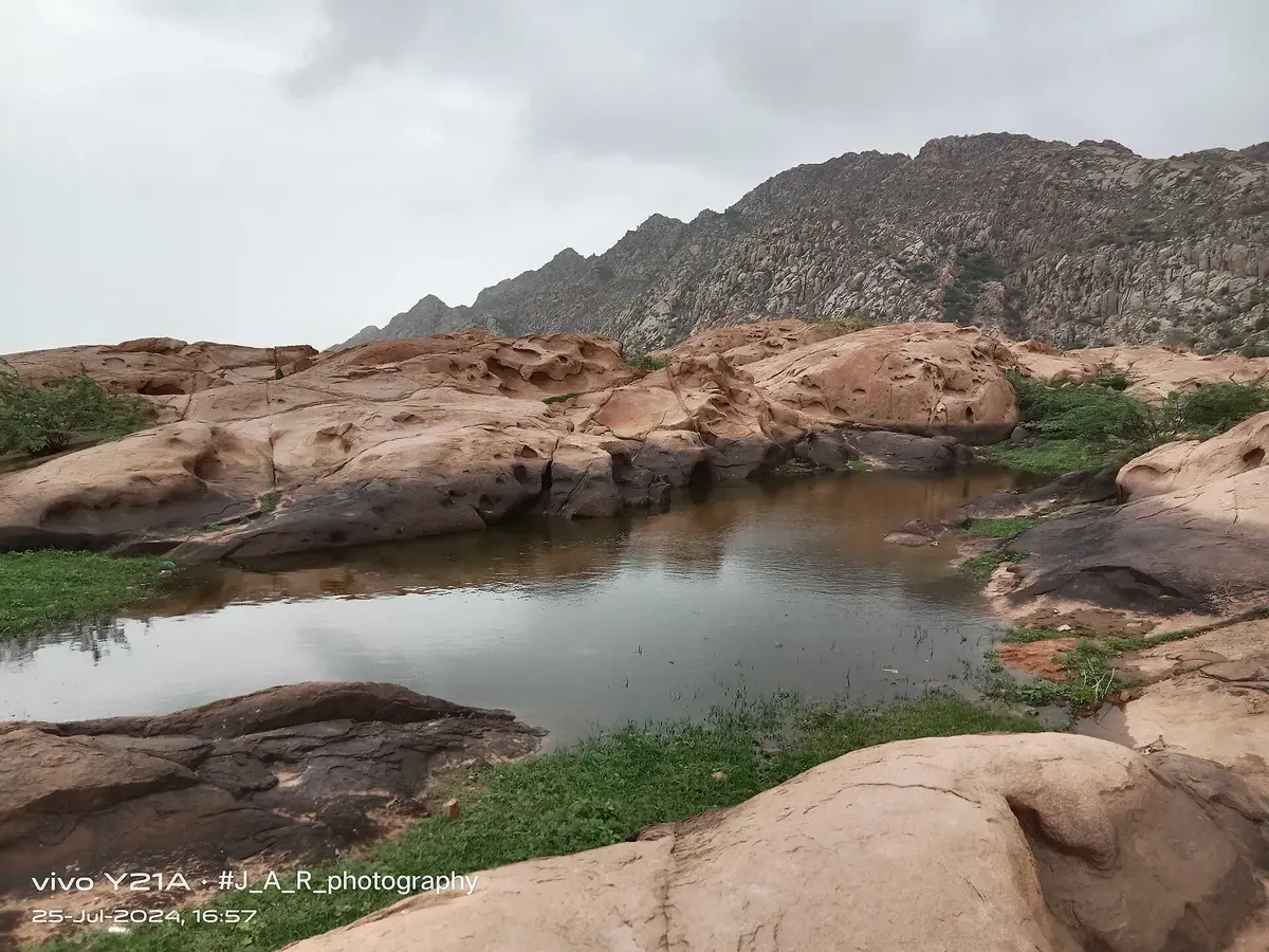
About 129 kilometres beyond Mithi lies Nagarparkar, the easternmost part of Sindh. Behind the town rise the Karoonjhar Mountains, pinkish granite hills that come as a shock after hours of flat sand. Locals like to say that Karoonjhar gives sawa ser of gold every day, meaning the wealth it provides through granite, china clay, honey and medicinal plants.
The hills are sacred to many people. The Churrio Jabal Durga Mata Temple draws huge crowds of pilgrims at Shivratri, and smaller shrines such as Sardharo and Anchlesar are tucked into the rocks. Nagarparkar is also proud of Rooplo Kolhi, the local hero who led resistance against British rule and was hanged in 1859. His statue stands in the town today. Lately, granite mining in the hills has upset a lot of locals, and you will hear strong opinions about it if you ask.
Most of all, Nagarparkar is known for its Jain heritage. Between the twelfth and fifteenth centuries, a wealthy Jain merchant community built beautiful temples across this area. At that time the sea came much closer, and trade made the region prosperous. A Jain hymn written in 1650 even described Parkar as the most glorious of all regions. About fourteen Jain temples survive in and around Nagarparkar, including the Bazaar Temple in the town itself, whose spire and carved gateway are still intact.
As silt from the Indus slowly filled the Rann of Kutch and pushed the coastline away, trade declined. Much of the Jain population moved away in the nineteenth century, and the last families left after 1947. Many of the temples are still respected and cared for by the area’s large Hindu community. This whole landscape has been placed on UNESCO’s Tentative List, which shows how important it is on a global scale.
Gori Mandir, a Fine Example of Jain Architecture
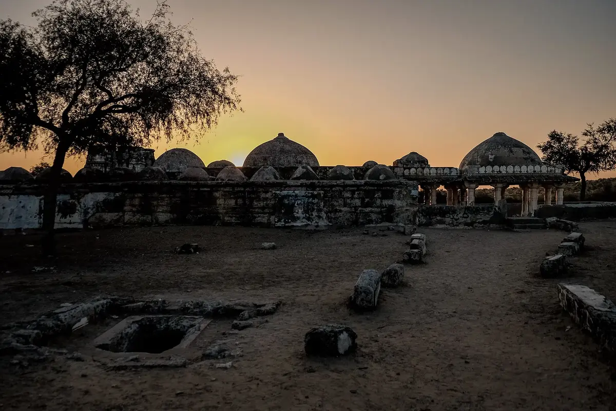
Of all the temples, Gori Mandir is the best known. It sits around 14 miles north west of Virawah and was built in 1375 to 1376 in the Gujarati style. It was dedicated to Parshvanath, the twenty third Tirthankara of the Jains, and for hundreds of years pilgrims came from far away to pray here. Local Hindus also respected its image, which they called Parasnath.
You reach it by climbing stone steps up to a raised platform. The building is roughly 125 feet long and 60 feet wide, mostly marble, with three halls (mandaps) and 52 domes on top. Carved marble pillars hold up the roof inside. Around the edges are 24 little cells, most likely meant for images of the 24 Tirthankaras. Monks may also have sat in them to pray, read or meditate.
All of this ties back to what Jains believe. The faith is built on non violence and self control, and on moksha, freeing the soul from being born and dying again and again. A temple was supposed to be a calm spot where you could work on that.
There is a lovely legend about how it all started. A Nagarparkar trader called Manga Oswal dreamed that a holy image lay buried under a house in Patan. He bought it, put it on a cart and was told not to look back on the way home. Near Nagarparkar the cart broke. That night another dream told him there was marble and treasure right under where he slept, and that he should build a temple there. The image was named Gori, and so was the temple.
Frescoes and Stone Carving at Gori Mandir
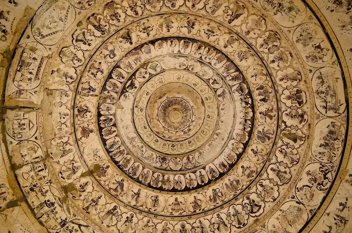
Step inside Gori Mandir and look up. That is where the real treasure is. Ceilings and the entrance canopy are covered in frescoes: Jain religious tales painted next to little scenes of everyday life, people, animals, processions. Experts consider them the oldest Jain frescoes surviving anywhere in the northern subcontinent. The stone, meanwhile, is carved with flowers, animals and neat geometric borders.
Why paint a ceiling at all? Most worshippers six hundred years ago could not read, and books were scarce. A painted ceiling worked like a picture book everyone could share, and a child lying on the cool floor could learn the stories of the faith just by staring upward.
The History of Gori Mandir and the Damage It Suffered
Gori Mandir has had a rough few centuries, and so have most of the old buildings around Nagarparkar. The famous image is said to have vanished in 1835. Later, British soldiers chasing a rebel Sodha chief through the area knocked parts of the temple about. Since then wind, rain, neglect and thoughtless tourists have chipped away at the rest.
The good news is that the temples are now protected under the Antiquities Act of 1975, and the Endowment Fund Trust for Preservation of the Heritage of Sindh, founded in 2008, has done some restoration here. Honestly, it is not enough yet. A lot more work is needed if these places are going to look like themselves a hundred years from now.
Virawah and Its Ancient Sea Trade
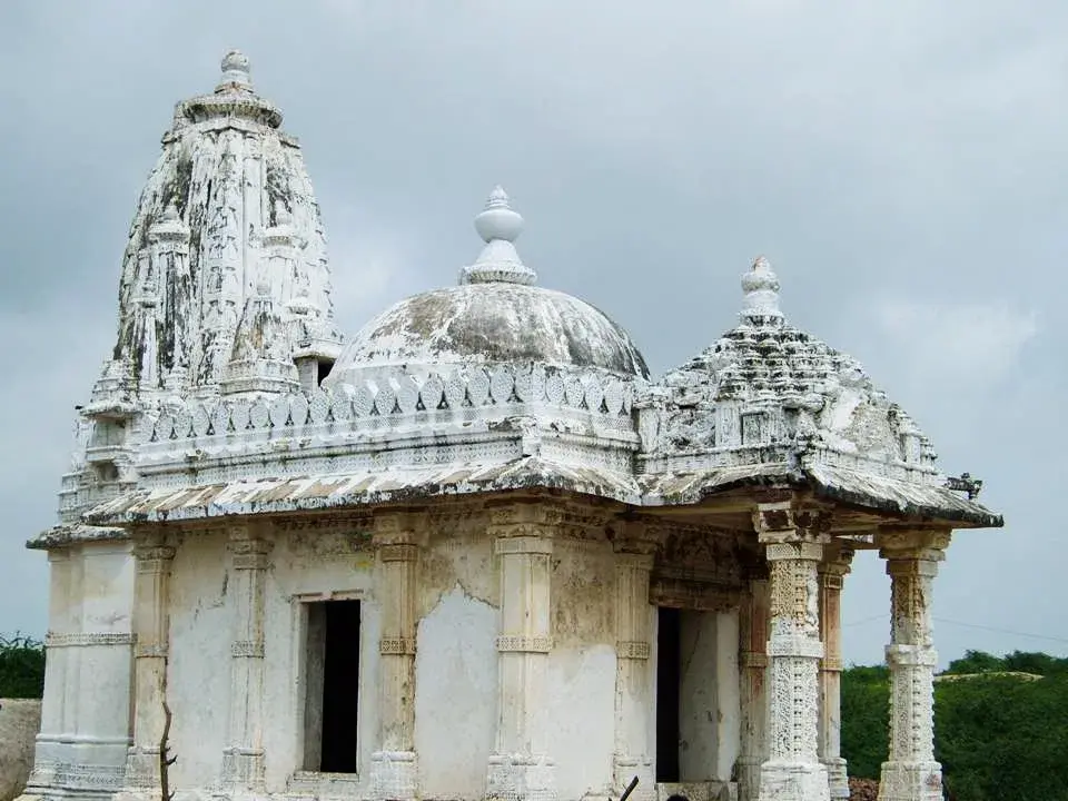
Virawah, about 15 miles north of Nagarparkar, is another important stop. It lies near the ruins of Pari Nagar, an ancient port on the edge of the Rann of Kutch. Locals will tell you the first temple here went up in 456 CE, built by one Jeso Parmar. What stands today is a good deal younger than that.
In its prime this area was a centre of trade and business. Old routes and waterways linked it with Gujarat and beyond, and the wealth of trade allowed the local community to build fine temples and grow culturally. When the coastline moved away, the port slowly died.
There were once three temples at Virawah. One, built of white marble, is still well preserved. A beautifully carved marble block from another was taken to a museum in Karachi during British rule. The third, now in ruins, had 26 small domes around a large central dome about 18 feet across. Some years ago, labourers digging for a new road hit a cluster of Jain statues. Locals placed some of them in the remaining temple, and others went to the museum in Umerkot.
Artwork of the Virawah Temples
The most striking thing about the ruins of Virawah is the stonework. The carvings show flowers, animals, geometric shapes, musicians and dancers, a sign of how cultured and prosperous life here once was. Much of it is broken now. What is left is still good enough to make you stop and stare.
For archaeologists these sites are extremely valuable. Nobody has dug here properly yet. A serious excavation at Virawah and Pari Nagar could rewrite a fair bit of what we know about this coast.
Bhodesar, Where a Temple and a Mosque Share One Style
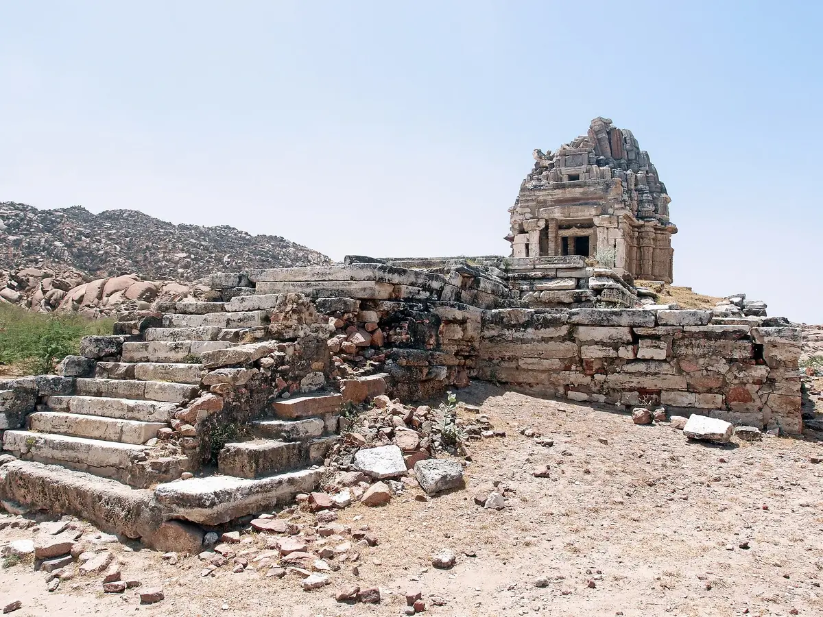
A few kilometres from Nagarparkar, Bhodesar was the capital of the Sodha rulers. Its oldest Jain temple dates to around the ninth century. Tradition says a Jain woman named Poni Daharo had it built, using carved stone laid without any mortar. Two later temples were built in 1375 and 1449. Nearby lies the old Bhodesar water tank, fed by the surrounding hills.
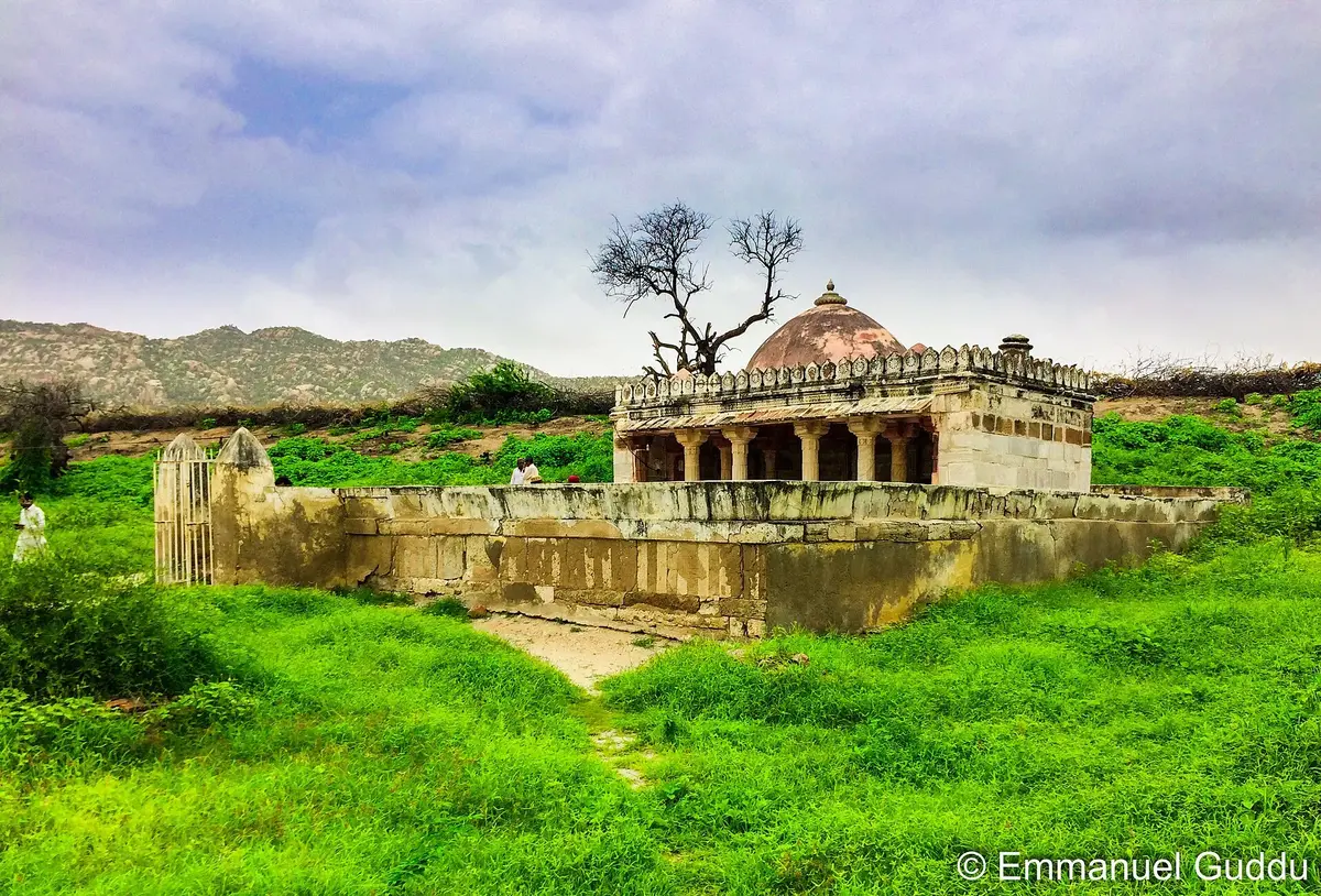
Right next to these temples stands the white marble Bhodesar Mosque, built in 1505 by Sultan Mahmud Begada of Gujarat. Its dome, pillars and decoration borrow clearly from the Jain temples around it. Few places show so plainly how different communities in Sindh shared craftsmen, ideas and beauty.
Nagarparkar and UNESCO World Heritage
In 2016 the Government of Pakistan submitted the Nagarparkar Cultural Landscape to the UNESCO Tentative List. The submission highlights the temples and mosque as architecture, and also as evidence of a Jain merchant community that depended on maritime trade and of the way a changing coastline affected settlement in the region.
A place on the Tentative List is the first stage of the process and does not yet mean World Heritage status. Before a site is inscribed, UNESCO examines several factors besides age. Authenticity concerns whether the original materials, design and workmanship survive. Integrity concerns whether all the features that give the site its value are present and intact within a clearly defined boundary. UNESCO also looks for an effective system of legal protection and site management. Nagarparkar has the historical value, and its future depends largely on the third requirement.
Planning a Trip Through Tharparkar
Most visitors travel by road from Karachi through Hyderabad and Mirpurkhas to Umerkot, continue to Naukot and Mithi, and then drive through Islamkot to Nagarparkar. The journey from Karachi to Mithi usually takes six to seven hours, and Nagarparkar is roughly 129 kilometres beyond Mithi. Three to four days is enough to see Umerkot, Mithi and Nagarparkar at a comfortable pace.
The cool months from November to February are the most comfortable for sightseeing. July to September brings green scenery after the rains, along with heat and humidity, while May and June are extremely hot and best avoided. Mithi has a few basic hotels and guest houses, and Nagarparkar has a small number of simple places to stay, so booking ahead is sensible around Eid, Diwali and public holidays.
Carry drinking water, sun protection and enough cash, because ATMs are limited outside Mithi. Nagarparkar lies close to the Indian border, so Pakistani visitors should keep their CNIC with them and foreign travellers should check the current permission requirements before setting out. Always ask before photographing people, especially women, and before entering homes or places of worship. Hiring a local guide is worthwhile, since guides know stories that are not written on any signboard and their fees support the local economy.
To see how these places fit alongside other landmarks of the province, explore our heritage map of Sindh.
Preserving the Heritage of Tharparkar
From Umerkot to Nagarparkar, you keep meeting the same idea: different faiths, languages and customs sharing one desert for centuries. Marvi’s loyalty, Akbar’s birthplace, Naukot’s brick walls, Mithi’s friendships, Mai Bhagi’s songs, the Jain temples under Karoonjhar. Put them together and you have Tharparkar.
We can share all of this more easily than any generation before us. A phone video, a short documentary, a blog post, a good photograph or an online archive can carry Thar to someone in Lahore, Dubai or London who will never see a dune.
Still, a nice photo does not fix a cracked wall. If you visit, take your rubbish home, keep your hands off the carvings, treat local families with respect and, when friends ask about your trip, tell them why these places matter.
Thar’s heritage is not the property of Sindh alone, nor of any single community. It is part of who we are as Pakistanis.
Final Thoughts
The road from Umerkot to Nagarparkar tells a rich story of Pakistan’s cultural and historical past. Umerkot Fort links visitors with the political history of Sindh and with the tale of Umar Marvi, while Akbar’s birthplace connects the town to the Mughal Empire. Naukot Fort recalls the Talpur era, Mithi offers a living example of peace between people of different faiths, and the folk songs of Thar reached audiences far beyond the desert through artists such as Mai Bhagi.
The Jain temples and archaeological sites of Nagarparkar, Virawah and Bhodesar provide strong evidence of the culture that developed in this region. Their stonework, frescoes and architecture show the skill of the craftsmen who built them many centuries ago.
Protecting this heritage is the most important step now. History is not confined to books. It survives in the walls of a fort, the carvings of a temple, an old folk song and the customs still followed in a village, and the land of Tharparkar holds all of these in remarkable abundance.
Frequently Asked Questions
What is Tharparkar famous for?
Tharparkar is famous for the Thar Desert, the religious harmony of Mithi, the folk music of artists like Mai Bhagi, colourful Thari culture, peacocks, the Karoonjhar Mountains and the ancient Jain temples of Nagarparkar.
Was Akbar really born in Umerkot?
Yes. The Mughal emperor Akbar was born in Umerkot on 15 October 1542, while his father Humayun was sheltering there under the protection of Rana Prasad, the Sodha ruler of Umerkot.
How old is Gori Mandir?
Gori Mandir near Nagarparkar was built in 1375 to 1376. Its frescoes are the oldest surviving Jain frescoes in the northern part of the subcontinent.
Is Nagarparkar a UNESCO World Heritage Site?
Not yet. The Nagarparkar Cultural Landscape was added to UNESCO’s Tentative List in 2016, which is the first step towards possible World Heritage status.
Who was Mai Bhagi?
Mai Bhagi was a celebrated folk singer from Thar, born around 1920 near Mithi. She became famous for the song “Khari Neem Ke Neeche” and received the Pride of Performance in 1981.
When should I go to Tharparkar?
November to February. The days are pleasant and the nights get chilly. If you want to see the desert turn green, travel during or just after the monsoon, between July and September.
Related Reading on PakSindh
- Sindhi Culture, a Complete Guide to Its History, Food, Dress and Traditions
- Ranikot Fort, the Great Wall of Sindh
- Makli Necropolis, the City of the Dead at Thatta
- Mohenjo Daro History and Visitor Guide
- Kot Diji Fort History and Architecture
Sources and Further Reading
- UNESCO World Heritage Centre, Nagarparkar Cultural Landscape
- Department of Archaeology and Museums, Government of Pakistan, Nagarparkar Cultural Landscape
- Nagarparkar Jain Temples, Wikipedia
- Naukot Fort, Wikipedia
Photo credits. All photographs in this article come from Wikimedia Commons and are used under Creative Commons Attribution ShareAlike licences. Each photographer is credited below their image. Featured image of the Gori Temple by Parkash Sarangani, Wikimedia Commons, Creative Commons Attribution ShareAlike 4.0.

Leave a Comment